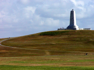
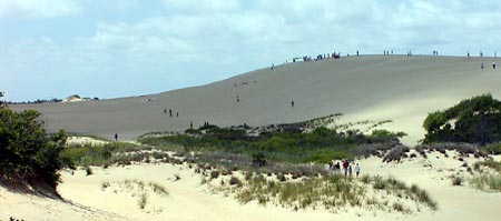
New York Slope Flying Sites
Thanks to Dave Garwood for this info that originally appeared in
an RCSD article in 1998.
|
LOCATION: Park in a gravel parking lot at the south side of State Route 2 in Petersburg, NY about 1/4 mile east of the NY/MA border. The flying site is 200 feet up a gravel trail to the south.
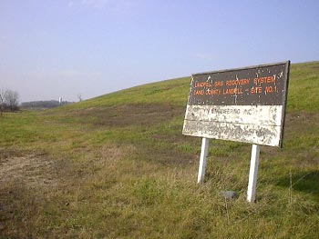
LAND MANAGEMENT: New York State Department of Environmental Conservation. Formerly a ski area, primary land use now is a hiking/backpacking staging area. Parasailors also use the site, though they launch from a partially cleared area across Route 2.
WIND CONDITIONS NEEDED: The west side is flyable in 5 MPH or more wind from the west or northwest. The big slope faces NNW, but is in the wind shadow of another peak to the north. The east side is flyable in SE 10 MPH or better.
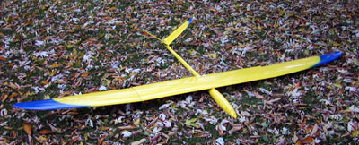
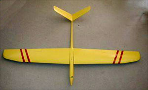
RECOMMENDED PLANES: In suitable wind conditions., anything you have trimmed well and can fly confidently.
|
|
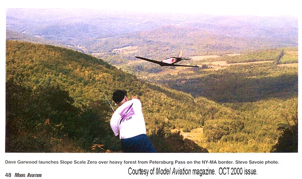
Petersburg Pass Slope Site
(NY/MA border)
If you are going through the Taconic Mountains that run along the Massachusetts / New York border you’ll find the Petersburg Pass Slope Site.
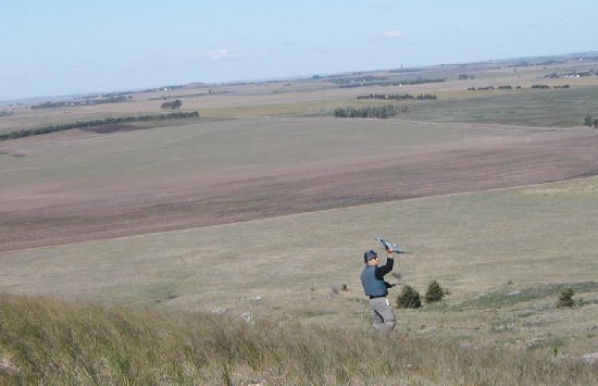
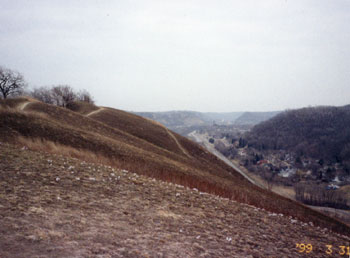
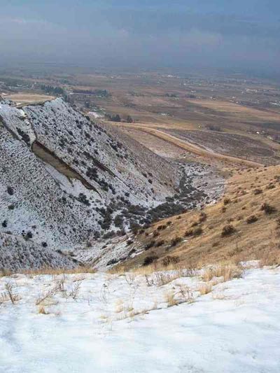
Pull into the parking lot at the top of the saddle back mountain on Route 2 between Petersburg NY and Williamstown MA, climb the gravel trail towards the south, and drink in two stunning vistas. To the west is Petersburg, and a bowl-shaped ridge that rises 900 feet above the valley floor. To the east is Williamstown and Mount Greylock, the tallest peak in the Berkshire mountains of western Massachusetts.
Both sides are flyable, and dynamic soaring is possible, if you’re really on top of your game.
This is Big Sky slope soaring, at least it seems like Big Sky to those of us who live where glaciers once covered the landscape. The bowl to the west creates a wide lift band when it’s working – you simply cannot fly out of lift and still see your plane.
“This is the best inland slope site I’ve ever flown,” said my 20-year old son, Lou, on our second trip there when we had 10-12 MPH wind. Lou’s been flying slope for about six years, and on that day flew a DAW 1-26, his trusty Sig Ninja, and a Slope Scale lead sled Mitsubishi Zero.
In 20 MPH, vertical development becomes impressive, supporting 250-foot loops. On his first visit there, Bob Powers quickly put away his NSP Sparrow and pulled out his ballasted-up carbon Renegade. “I don’t think we’ve ever flown this fast at Cape Cod,” Bob said after a few whistling fast passes.
The east side is flyable in SE wind, but so is Mount Greylock, only about 20 miles away, and in rare SE wind Greylock is the place to go.
Petersburg Pass is not a beginner flying site nor a spot for the faint of heart. It has the absolute trickiest launch point that I’ve seen in ten years of flying slope in eight states. You must launch through some intense turbulence and shoot through a break in a tree line until you get out into the lift, holding the nose down all the while to keep the speed up. It is an adrenaline-pumping moment, because there trees below.
Many trees.
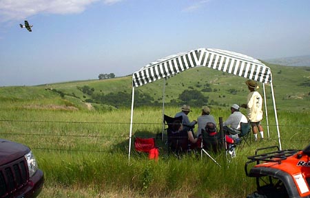
The landing zone is surprisingly docile. It’s a grassy area about 100 by 125 feet containing only a few bushes and one surveyor’s stake on our last visit. It is amazingly free of turbulence and if you set up a reasonable landing approach you can grease it in on grass. If your downwind leg is too long, though, you’ll be in the tree line at the east end of the LZ.
CAUTION 1: Do not fly an untested or untrimmed plane at this site, at least not in wind higher than 5-8 MPH. Do not launch a plane with shaky batteries here.
CAUTION 2: If losing a plane will cause you permanent emotional damage, do not fly here. If a plane goes down over the forest below it will likely be impossible to recover.
CAUTION 3: The Taconic Trail, a recreational hiking trail exits the woods smack into the center of the LZ. On landing, and for close-pass maneuvers you must post a spotter at that trail to watch for hikers. If we were to hit a hiker accidently, it could easily get us kicked out of the site.
These cautions are less urgent in lighter wind conditions. You can fly HLGs and long wing floaters in 3-5 MPH with less risk. Flying light and medium aileron slope soarers in 5-15 requires some attention to maintain safety. Flying slope screamers in 20 MPH or higher commands serious attention to safety issues.
All in all, Petersburg Pass is one memorable slope site. If your thumbs are up to it, consider putting it on your New York / New England travel itinerary.
These are locations we have had the privilege to fly. Some may have access restrictions.
Check with local flyers for information.