slopeflyer.com

West Sydney Slope Soarers

Stephen, the President of the West Sydney Slope Soarers sent in this note.
We have our own registered site at Mt Annan about 40 minutes south west of Sydney. The hill offers a great range of opportunities for every level of slope flyer including DS.

Stephen is also on the committee for the SSA of NSW that Klaus has submitted.

Having these to sites available allows us to fly 12 months of the years as the summer is the coastal season and winter when the winds turn westerly its back to our inland slope.

The club site is at:

http://swenban.rchomepage.com/page.php?id=1

Check out the great slope database for a bunch of Australian Slope Sites.

Middleton Mountain Vernon B.C. Canada

The view from the picture is looking south over Kalamalka Lake.

Middleton Mtn is located just outside of Vernon B.C. which is in the Okanagan Valley of the B.C. Interior. Approximately 5 hours from Vancouver B.C., 6 hours Calgary, and 2.5 hours from the Washington border. The summit is about 630 metres ASL.

Slope flying exists on South, SW, West and East ridges of Middleton Mountain. Treeless top with natural bunch grass, and with just an occasional rock to watch for makes for nice landing. Flying is at the summit only as development has wiped out all the lower grasslands, along with numerous smaller slopes that existed. There is still a nice slope that leads to the summit and it does not appear that this or the top will be developed. The lift seems a little more choppy with the houses built below but is still great. South to SW winds are predominant, but East winds when they occur are great.

The easiest way to get here would be to drive out from Vernon on Hwy 6, turn on to Middleton Way and follow the streets to Mt. Ida road. Follow Mt.Ida West and come to a cul de sac. Unfortunately one now has to hike approx 10 minutes up the slope but well worth it when the wind is blowing.

Vernon used to have a very active RC soaring club in the 70’s and early 80’s (NWSS affiliated) but there is no activity at this time. Would be happy to show anyone this site that would be interested. Contact ctopf@shaw.ca.

Wreckhouse Section of the Long Range Mountains in Newfoundland

While attempting to get a handle on my out of control email Inbox, I came across this link that Mirko sent me a long time ago. I’ve been meaning to figure out how to get a trip to this place!

http://www.stemnet.nf.ca/CITE/tourwreck.htm

I don’t know if anyone has ever sloped this area but I’d sure like to give it a try! No trees, lots of wind and steep mountains sounds like a slope flyers paradise.

{pgomakase}

Lawrencetown Slope Soaring near Halifax, Nova Scotia, Canada

Lawrencetown Slope Soaring near Halifax, Nova Scotia, Canada.

A small group of us slope soar near Halifax at Lawrencetown on a bluff right on the Atlantic Ocean.
This is our site which includes three image galleries and a small movie:
http://users.hfx.eastlink.ca/~sryan/flying.html

This is our informal forum/log/story page:

http://users.hfx.eastlink.ca/~sryan/lawr-soar/blogger.html

-Steve Ryan

Steve and his SR-7

Stormeflyers Club in North Wales

We are a small active group of all weather flyers who are fortunate enough to live within the close proximity of the Great Orme in beautiful North Wales who fly various radio control model gliders ranging from dynamic soaring to combat EPP to full blown composite screamers and PSS.

Visit the club’s website:

http://www.geocities.com/stormeflyers/mypage.html

http://www.geocities.com/stormeflyers/stormeflyers_pics.html

Sloping in Saint John, New Brunswick

Slope flying at Red Head Slope facing due South in Saint John N.B. Overlooking the Bay Of Fundy.

The slope is at a former Coast Guard site, and as far as I know it still is. The site is only good for South and South-West wind, but that is the direction the wind blows most of the time. It is a beautiful site with about 80-100′ bank, and the slope is about 1 mile long. There are always some bubbles around too as a small arm of land is sticking out on the left side about a 1/4 mile away from the slope. The landing site is a bit of a challenge due to the rotor, but it is all flat and covered with a hardy green plant about 3 feet high and it makes for a good cushion if you miss the little grassy spot about 50′ square.
Read more

Winter Sloping in England

Hi Greg,

I do have a few stories about slope soaring.

Let me tell you about the annual Christmas slope outing. Every Christmas I go out into Derbyshire, sometimes I can persuade other pilots to come along.The idea is to fly over the Christmas holiday period, a day is chosen fingers crossed it is dry, the temperature at the top of the hill is very often minus 5 to minus 15.

One of my favourite slope sites is located between Castleton and Edale in the Derbyshire Peak District.
Read more

Traveling to and Flying in France

Some of these commentaries and accounts of my slope flying over the past several years in France may be useful for temporary visitors living in France, or someone doing business there on a regular basis.

Directions to Menez Hom

For anyone coming from the east, Paris, Chatres, Le Mans, Rennes, St. Brieuc, Morlaix, Landavisiau, Sizun, Chateaulin, are the cities that you will bypass, then finally take the direction for Crozon.  This is your route to Menez-Hom.  From Paris this is just under 400 miles.  From Germany, it is over 700 miles.
Read more

Slope Soaring Sites in New Zealand

New Zealand Slope Flying Sites
Thanks to Aaron for the following info.

Being a country of mountains, valleys and volcano’s there are absolute tonnes of slope soaring sites. the most popular however are:

Auckland:

Mt Wellinton: An old volcano, this can be flown on in any wind direction. Most popular are S/W, S, E, NE, N. You will find fliers here most days from 3pm till dusk.
It is also an excellent site for DS in SE, E, NE wind directions. Best of all is that in N and NE winds you can launch straight from the car.
Read more

Beg an Fry and the roast road, Brittany

March 25, 2002, Monday

Beg an Fry and the roast road, Brittany (France)  Temp: 6 C, morning; PM temp: 15 C; wind 6-10 knots from the NNE

Back on the road headed south from Primel-Tregastel, to Plougasnou then east along the coast road passing the point, Beg Gracia to again explore the fabled point, BEG an FRY. This time, after lunch, the “holy hour” in France, my wife came along, since she had never been BEG an FRY.  The word “BEG” means “point” in the Breton language. This sunny morning had been virtually windless, temperature was now near 60 F.
Read more

The Bunker Pointe Annalouseten, Brittany, France

March 21, 2002

Pointe Annalouseten, Brittany, (France)   Temp: 13 C; wind 15-20 knots from the WSW

“The Bunker”

Skies are still gray; the wind has relented a bit this morning. After 10:00 AM, it rained pretty hard for three hours.

However! I got two good flights before the rain started. I started with the mini Pilatus, which had only two flights up to today. The launch was fairly easy; I cranked in one click of down trim, since this plane only weighs 19 ounces. It went up like it was on an elevator. Cruising forward in this moderate wind was not a problem. This is a very easy plane to fly.  But I did find that the plane would not roll. So I will have to do some adjustments on the aileron throws.
Read more

Pointe Annalouseten, Brittany, France

Pointe Annalouseten, Brittany, (France)  Temp: 12 C; wind 30 knots from the west

No rain today!  Skies are still gray.

I went over to Pointe Annalouseten at about 9:30 AM and flew for about 30 minutes. Launching the Sagitta was tricky; I had to walk down the path about 20 yards to launch in less turbulence. The plane went up like it was on an elevator. Gulls cruised through the area and I chased them all over the sky.  They like to play. I worked my way slowly backward up the path to the road and kept on a-cruising’ with the German made Sagitta.
Read more

Primel-Tregastel, France

Primel-Tregastel, France Temp: 50 F; 10 C

Subject: Good finish to a bad day

I’ll sum up today: a bad day turned into a good day. This morning I checked the immediate area for south facing slope due to the persistent south wind the last few days. Staying on the north side of Brittany makes it very tough to find a south facing slope.

After consulting a very detailed IGN map, I drove over to the very well to do town of Carantec, about 30 miles away.  This is on the other side of the Bay of Morlaix; in a straight line across the water it is only 5 miles.  But this is Brittany and most travel from one point to another is rather tortured due to the terrain.  There was a fairly high south facing slope there, 200 to 300 feet, but no access due to every inch being private property with very expensive houses on large lots. The wind was blowing 30 knots and the gulls were cruising beautifully over this ritzy area.
Read more

Flew some light wind at the Menez-Hom

Saturday, March 16, 2002

Finally flew in some light wind at the Menez-Hom, Brittany’s highest hill (1000 Ft).  We arrived about 3:00 PM.  This site is about 50 miles from our cottage in Primel-Tregastel. The wind was out of the south about 8 or 9 mph.

The little Pilatus flew for about 10 minutes.  Then I got about a five minute test flight with the Pixel.  This was trimmed perfectly and was very easy to fly.
Read more

More Commentaries on Flying in France

Roissy, France; Charles de Gaulle Airport

The Airbus arrived on time from Chicago: 8:20 AM;  disembarkation was a waste of time.  We were loaded on to special airport tarmac buses some distance from the terminal.  This took at least a half an hour.  Wait on the plane, then wait on the bus.  Luggage pick up was a little slow:  it took 20 minutes: It took another 20 minutes to find the car rental area; this was more annoying due to public phones that didn’t work when we tried to call the car leasing company.

We finally got picked up by the car leasing company, and were driven to the pick up area.  This was very quick.  Two signatures, they loaded our luggage in the car. It was a turbo diesel Renault Megane Scenic.   Amazingly it all fit, luggage, even the Sportube, with the three planes, which easily fit on the back seat from one door to the other. We were on our way at about 10:30 AM.

As we left, I noticed that the Roissy airport had a dingy look to it; remarkable since this was built 20-25 years ago.  Skies were the usual gray of Northern Europe at this time of the year.  We picked up the expressway to the Paris beltline, which is also called the PERIPHERIQUE.


This took at least 45 minutes and you better have a pretty good map.  It is better to have a two person team for this: one to drive; one to navigate.  Traffic was absolutely nuts, being worsened by the weaving, high speed, lunatic motorcyclists.  Again, I was disgusted by the run down look of these suburban areas along this expressway.  This is one of the most forgettable places that I have ever driven through, loaded with big ugly commercial, buildings, low cost housing projects, and a chaos of high speed traffic, that one does not want to repeat very often.

The problem of going to Brittany from north of Paris is that you have to get to the southwest side of the Parisan suburbs to pick up A-10, which heads west.  This is a Peage road which is expensive for the 200 miles that you use it.  About $20.00 (23 Euros).  This is the fastest and safest road.  The whole trip was about 350 miles to the town of Plougasnou, on the north Breton coast.  The last two thirds of this five hour trip was driven through rain.  We arrived at 4:00 PM, which was good, considering the two gas stops and the food stop on the Toll road.  Food service is excellent at these restaurant toll road stops, which will also sell you beer or wine with the food.  If you are seen drinking alcohol without eating at these food stops, you are liable for arrest in this country.

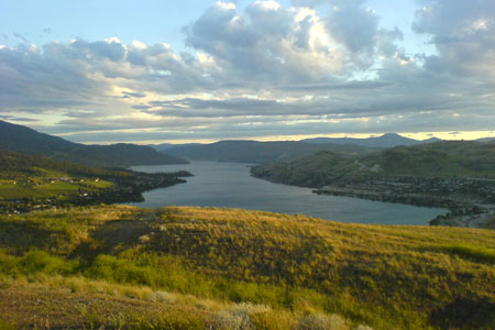
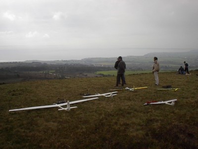
It’s not raining now, so I am hoping to go flying this Friday morning when we get some of that gray miserable sky that northern Europe is so famous for, but without the rain.

Scroll To Top
Skip to toolbar