These are locations we have had the privilege to fly. Some may have access restrictions.
Check with local flyers for information.
Sloping the Kapuna Point Sea-Cliff at Waihe’e
Thanks to Duane Asami for permission to use this info.
In May of 1998, Alvin Battad of Kahului set the current A.M.A. Class-A Slope Duration Record at Kapuna Point. Members of M.I.S.O. met at 5:00 a.m. to get ready for Al’s flight and after much prodding, Al launched his Mel Culpepper designed Hummingbird at 5:40 a.m. Twelve-hours-twenty-eight minutes later, he landed with a great suntan and a new A.M.A. Record.
Kapuna Point, generally called Waihe’e (the nearest town) by the local fliers, is a small sea-cliff north of Wailuku. The flying there is great and the lift is endless when the trade-winds blow. Unfortunately, the landings there are not as wonderful as the flying. This is not the place to toss an expensive glass or carbon plane like a Vindicator. If you have a foamie or a less expensive hard-body plane, fine. You may get it home in one piece or you may have some new dings to reminisce about after you leave here. I learned to fly aileron ships at Waihe’e and I’m glad I started with a DAW P-51 foamie Mustang.
Planes that do well here are mostly the foamies, only because of the landing area. The DAW Foamie Mustang, the Studio-B EPPee, the Zagi, the Foameron, etc. Hard-bodies like CR’s Renegade and Excel fly very well here, but take a beating on the landings. When the winds are light, it’s also possible to fly polyhedral ships here such as the Gnome 2meter and the Sophisticated Lady.
WARNING: Before you fly at Waihe’e, you must understand one inviolable rule. You are not allowed to fly when there are people on horseback anywhere in the area. If there are people on horse-back anywhere in sight, DO NOT LAUNCH! If you are in the air when they enter the pasture, LAND THE PLANE! We are allowed to fly at this site only because we have the permission of the ranch which owns the pasture. They run trail rides for tourists. If your plane spooks a horse, someone could get hurt so they don’t allow anyone to fly when riders are anywhere in the area. If you can’t live with this restriction, don’t fly here…some of those cowboys take this stuff very seriously. There are several tales of fliers breaking these rules and being thrown out or punched out!
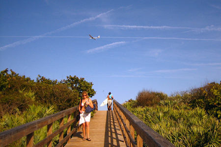
Finding this site is not particularly difficult. Follow Kahului Beach Rd. north-bound from Ka’ahumanu Ave. (the main highway connecting Kahului to Wailuku) along the coast past the harbor. Take Waiehu Beach Rd. (340) to the intersection with Kahekili Hwy. (330) Turn right and Kahekili Hwy. 330 becomes Kahekili Hwy. 340. Follow Kahekili Hwy. (340) to mile-marker 5, then measure exactly .5 (half) mile from the mile-post marker to a paved shoulder where you can park. Look out over the sea-cliff and you should see a natural arch in the rocky shoreline to the left and directly below you should be a short stick with a couple of plastic streamers on it.
Before you launch, check the wind. If it’s blowing at least 10 mph and if it’s blowing directly into your face from the sea, you’re alright. If it’s from the left, the lift is going to be poor and hard to fly. If you do decide to launch, look for lift way out on the right, just outside the cliff face and beyond the stand of ironwood trees. If the wind is from the right, DON’T LAUNCH. Flying at Waihe’e can be great but losing a plane there can happen in seconds and can be very permanent. It may look like a small pasture with short brush, but there are large (100″ span) planes still lost in the bushes there.
Flying at Waihe’e is wonderful. The view is great, the lift is nearly endless and it’s a ten minute drive to the nearest McDonald’s. Launch and fly straight towards the sea. Don’t expect much lift before you pass the cliff-face because it isn’t always there. Stay away from the bowl area on the right if you don’t have lots of altitude, the air gets really dirty really fast back there.
The landings at this site are interesting. Generally, you use that dirty air in the bowl on the right to kill off altitude as you approach from the right. Drop below the level of the hill to make your approach. As you climb, your plane will lose energy so you should be just above stall as you get to the top of the hill and can land without skidding too far. The landings are generally cross wind here, otherwise you’ll be landing with your plane speeding towards you. Not so bad if you judge the approach perfectly but not to great if you misjudge and put the plane into the fence or your car. Also, be careful of the short scruffy looking bushes, they eat carbon-fiber wings for lunch.
Local Pilots
Duane Asami

 04/06/02 – Update


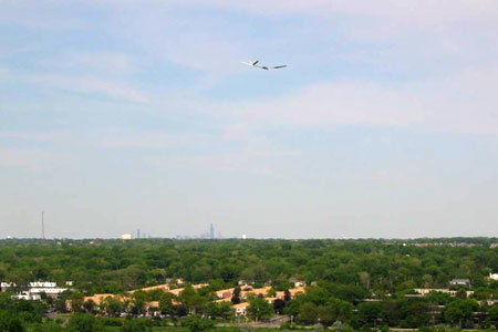


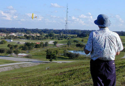
 I have been soaring the only site I knew of near Lake Okeechobee until I saw your links. I put together a web page describing it for anyone interested in it. I have been flying R/C for 25 yrs, Hang gliding for 10yrs and slope flying for about a year. I am now an R/C slope junkie, bigtime.