slopeflyer.com

My Presentation on Radio Control Modeling to My Wife’s 2nd Grade Class

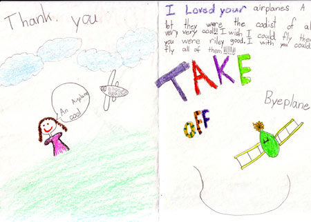
A couple of weeks ago I did a presentation on radio control models for my wife’s 2nd grade class. All 26 of them! Her class was reading the book Mr. Putter and Tabby Fly the Plane in which Mr. Putter gets a radio control plane and flies it. Wendy reads the book to her class every year and though the kids would enjoy seeing a real R/C plane in action.

I met her class on the playground of their school. I had about 30 minutes to do the presentation so I started out with a brief overview of radio control models and the different types like sailplanes, power planes and helicopters as well as other vehicles like cars. I told them that my particular interest is sailplanes and explained a bit about how they stay in the air.

{pgomakase}

I brought a few planes to show including the RaceM which I used to show how the control surfaces work and because the size of the plane is impressive. There were lots of Oohs and Aahs when I stood the RaceM on its wingtip since the span is over 10 feet. I showed the MiniSR and explained that it is made to go fast. A lot of the kids were surprised that a sailplane could look like a jet. I also had my CombatWings XE electric wing that I brought so I could show how durable a beginning RC plane can be. I also brought it to fly because the school does not have a big field and the wind was blowing 20 to 25mph!

Read more

Buena Vista, Newark, Licking County

80 feet, bowl

Driving Directions-Exit I-70 onto northbound Buena Vista Street.  Drive north until the slope opens up on your left.  Park at the north end on a public parking lot.

Wind Directions-West to South-Southwest.

Landing Zone-pretty decent, but with a strong rotor near the lip of the slope.  If necessary, go high and fly east across Buena Vista Street and land in the farm field.

Hazards-metal guardrail at the lip of the slope

Access-public park land.  Be considerate.

Map Link http://topozone.com/map.asp?z=17&n=4436400&e=381023&s=25&size=l&datum=nad83&layer=DRG25

Buck Creek State Park, CJ Brown Lake, Clark County – Slope Flying Site

Buck Creek State Park,  CJ Brown Lake, Clark County

This slope flying site is a 75 foot grassy dam face in a State Park.

(note from the editor: Dam faces often work great for DS give this one a go in East wings and let us know how it goes!)

Driving Directions – From I-70 exit onto US Route 40 just east of Springfield. Go about two miles west on Rt. 40, and then turn north on Bird Road. Follow Bird Road into Buck Creek State Park, drive along the south side of the lake, and then follow the signs  around to the park headquarters

Read more

Scroll To Top
Skip to toolbar