slopeflyer.com

Middleton Mountain Vernon B.C. Canada

The view from the picture is looking south over Kalamalka Lake.

Middleton Mtn is located just outside of Vernon B.C. which is in the Okanagan Valley of the B.C. Interior. Approximately 5 hours from Vancouver B.C., 6 hours Calgary, and 2.5 hours from the Washington border. The summit is about 630 metres ASL.

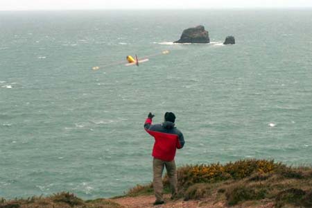
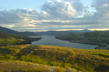
Slope flying exists on South, SW, West and East ridges of Middleton Mountain. Treeless top with natural bunch grass, and with just an occasional rock to watch for makes for nice landing. Flying is at the summit only as development has wiped out all the lower grasslands, along with numerous smaller slopes that existed. There is still a nice slope that leads to the summit and it does not appear that this or the top will be developed. The lift seems a little more choppy with the houses built below but is still great. South to SW winds are predominant, but East winds when they occur are great.

The easiest way to get here would be to drive out from Vernon on Hwy 6, turn on to Middleton Way and follow the streets to Mt. Ida road. Follow Mt.Ida West and come to a cul de sac. Unfortunately one now has to hike approx 10 minutes up the slope but well worth it when the wind is blowing.

Vernon used to have a very active RC soaring club in the 70’s and early 80’s (NWSS affiliated) but there is no activity at this time. Would be happy to show anyone this site that would be interested. Contact ctopf@shaw.ca.

Deer Island Slope Site Near Boston

David sent this in from The Granite Glider Guiders a southern New Hampshire area club.

Deer Island is just minutes from downtown Boston and offers both east and west facing slopes. The property is part of the Boston Harbor Islands National Recreation Area. Public areas are open dawn to dusk every day. Using the address 175 Tafts Ave., Winthrop, MA 02152 will get you close.  The parking area is at the end of Tafts Ave.
Read more

Berry Pasture Trail New Hampshire Slope Site

Berry Pasture Trail has long been a popular hiking trail leading to Burton Peak on Temple Mountain in Sharon, NH. A timber harvest was completed during the summer of 2007 which provides great views of Mount Monadnock and some awesome soaring when winds are blowing from the southwest. Use the Google Map below to get driving directions to the parking area.

From the parking area it’s a strenuous 15-20 minute climb to the west facing slope site. Just follow the triangular blue blazes until you come to the clearing.

The site is accessible in winter, but Mountain Road is not plowed by the town.  Four wheel drive (along with common sense) is highly recommended when the road is covered in snow.

Continuing up Berry Pasture Trail leads to the summit of Burton Peak.  Near the top it meets up with the Wapack trail which is marked by yellow blazes.  Follow the trail uphill until you see the blue blazes break off to the left. When the wind is north-westerly this area probably provides much better lift.  However, it’s pretty tight and not for the faint of heart.

Here is a link to a Google map of the area.

Polecat Aero

Polecat Aero – I originally got my Xterminator here several years ago and have since owned several planes from Polecat Aero. Denny is very helpful. He has answered every question I had in a timely manner and expresses a genuine interest in my experience with the kit I got from him. I sent a couple dozen emails to him and they were all answered in less that 24 hours. There was a slight delay when I ordered as mine was one of the first complete kits he had put together, but he kept me informed and the wait was short.

Scroll To Top
Skip to toolbar