slopeflyer.com

Flying at Oacoma, South Dakota

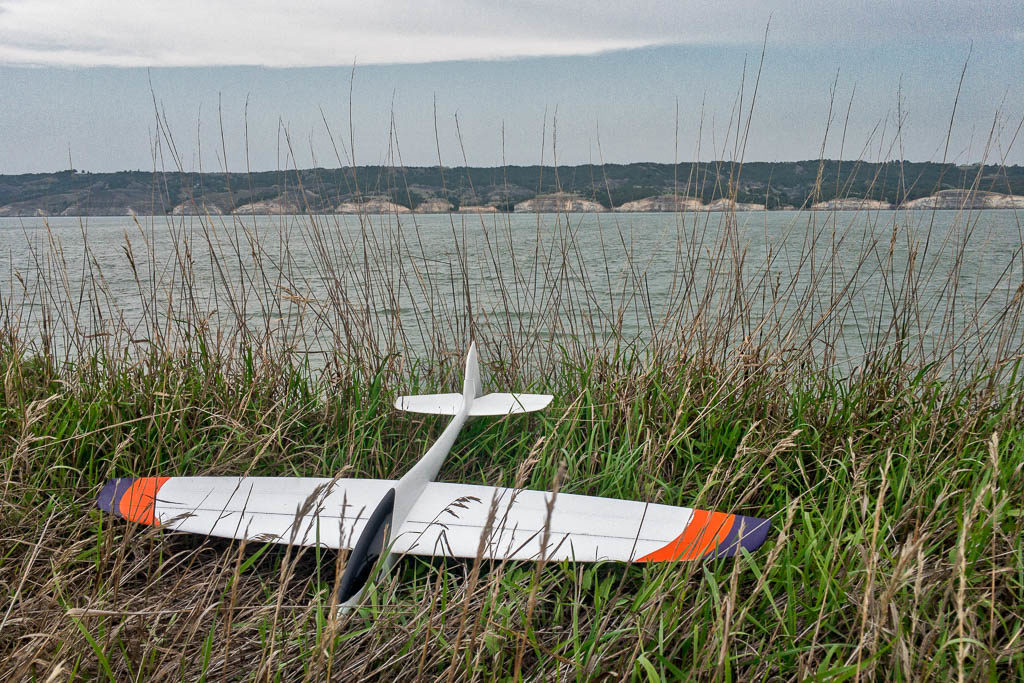
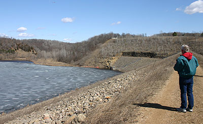
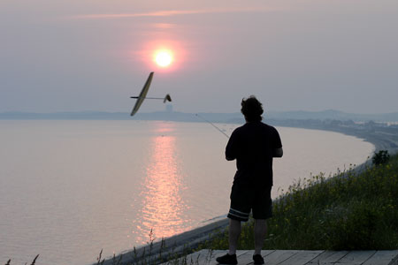
Ahi on the shore of the Missouri River
Ahi on the shore of the Missouri River.

I stayed in Oacoma, SD for a couple of days on our way to Wyoming for the Solar Eclipse 2017 and, between family sight seeing including a couple of dams and the capitol at Pierre, I got in a bit of flying.

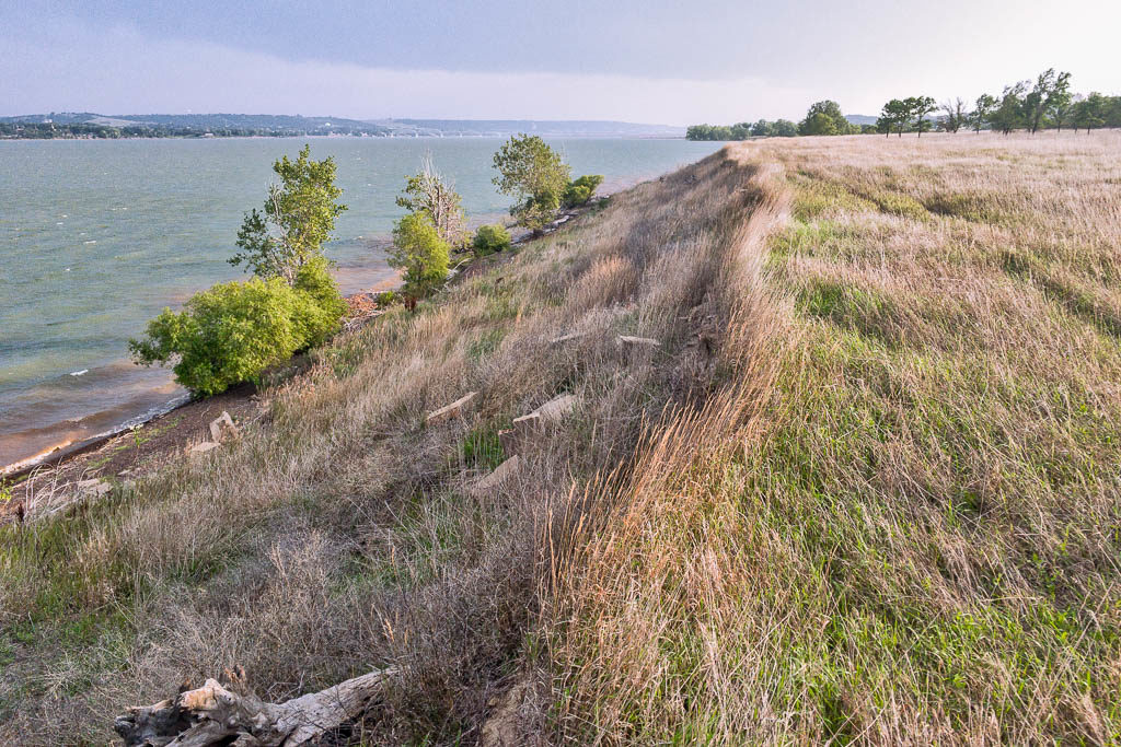
We stayed at the Arrowhead Cedar Shore Resort in Oacoma that is right across the Missouri Rover from Chamberlain, the HQ for many a slope trip to South Dakota. Mostly just passing through but since the resort is right on the shore of the Missouri River I thought, maybe, I’d get a chance to fly a bit. As it happened, time was short but the SE wind was a decent direction for a gander op the shoe north of the resort. I hit pay dirt about 1.5 miles north of Cedar Shore on some Public Land that had about a 30 foot slope with the wind coming straight in at about 15mph.

First time flying this shoreline slope that is 1.5 miles north of the Arrowhead Cedar Shore Resort in Tacoma, SD. Notice that the shoreline bends to the right past the trees for a more southerly direction, Plus, no trees!

My first bird in the air was, of course, the Weasel. I was only moderately hesitant to throw the plane in the air, not because I didn’t think the slope would work but because I’d left the wing screws and the Blenderm tape back at the hotel! No matter, I figured the magnets holding the Weasel-Trek together were strong enough for an exploratory flight and, after about 20 minutes I was proven right on both counts. The plane held together and the slope worked!

Even though I had no problem with the Weasel holding together with no wing screws, I didn’t want to try the same with the Ahi. That, and I wanted long pants to trek through the tall grass to get a bit further down the slope. So, back to the hotel I went. 15 minutes later I was back at the hill putting together the Ahi with wing screws and tape!

As I was putting together the Ahi I decided to add 2 ounces of ballast because the lift was a bit bumpy and I wanted to try to smooth it out a bit. Seemed to work fine as the Ahi grooved right out of my hand. By this time the wind had also picked up close to 20mph. I had a good flight just getting to know the Ahi and, while the lift was OK, I think the increased wind velocity started to blow the lift band out a bit. No matter if it stays int he air I’ll fly that thing!

My final flight of the day was another Weasel flight with the full confidence of a screwed and taped bird. Wonderful!

If you find yourself in the area and don’t want to drive to the bigger slopes outside of town, this is a very flyable shoreline slope that worked well in a Southeast wind. I think 12-15mph would be ideal for the dream-flight dream team of the Ahi, Weasel and Alula!

8/17/17

Connecticut Slope Soaring in Bloomfield

A nice grass NW slope about 80 feet high is located behind the Seabury retirement home on route 185 in Bloomfield. Park in the parking lot on top of the hill. The slope is owned by the town so don’t let rent-a-cops from the home say you can’t be there. There is an RC field out to the right of the hill so check frequencies if anyone is there.

  • GPS Coordiantes:
  • N 41 degrees  50.201 minutes
  • W 72 degrees 42.460 minutes

Have more slopes to share? Please post them. This sport depends on sharing our slopes.

Slope Soaring Sites in Connecticut near Bristol

A nice multi-direction site that has N, NW, W and E faces about 80 feet high is located on Perkins Street in Bristol, CT.

It is an old gravel mine area that is now a rustic dog walking area owned by the town. Use the nice parking lot they created and feel free to bring a weed whacker to clear off the top of the slope. The slope requires a 1000 foot walk from the parking area.

  • GPS coordinates:
  • N 41 degrees  41.595 minutes
  • W 72 degrees 57.938 minutes

A SW slope is on the west end of a large sloped field in Bristol. It is just east of a large factory complex on James P. Casey road. Use on weekends only. Park in pull out on the factory driveway at the bottom of the slope. Site is posted for snowmobile trespassing but has never been a problem.

  • GPS Coordinates:
  • N 41 degrees  41.617 minutes
  • W 72 degrees 58.677 minutes

Have more slopes to share? Please post them. This sport depends on sharing our slopes.

Rhode Island Slope Soaring

Jan sent in this info. Thanks for the first info about Rhode Island!

Here’s a link to a couple of slope sites in Rhode Island – yes, RI. Provided by Dr. Bill. Haven’t flown there myself. http://www.risoaringclub.org/

Jan says “It’s been a cold and rainy summer out on the Cape so far with very little chance to do any slope soaring due to closures. Looking forward to Labor Day.

Regards,
Jan

South Dakota Slope Trip April 2009

Dave and I went on an early season slope trip in mid-April 2009. We met Rob and about a dozen other dedicated slopers on Thursday and had a couple of good days of sloping at The Pasture in NE wind conditions.

Some of the highlights of the weekend were:

  • Maiden flights for several of DaveO’s planes including a Jart Lite, Ruby, Predator and Destiny.
  • Flying my V-Ultra both days. It has been too long and I love that plane!
  • Maiden flight of the McLean Vector2 that DaveK just finished. Gotta get mine done! That is a seriously excellent plane!
  • Listening to DaveK’s vacuum bagging technique tips.
  • Hanging with the Watertown boys.
  • Dinner at Charly’s

I’ll be heading out again for a few days in mid-May. Hope to get some DSing in them and look forward to seeing the crew again.

As always, if you are interested in sloping in South Dakota contact Rob. He will be able to tell you what you need to know if you want to join us.

Montana Slope Soaring in Missoula

Montana Slope Flying Sites

Jim Crook – Missoula jimcrook@marsweb.com
I have flown on a local hill, that seemed fine to me, but I have never been to a slope site that was known as a good site so I have nothing to compare my hill to. If you are in the area, and you are a sloper, maybe you can give an experienced evaluation.

Here are the directions to the hill in Missoula.

  • From Hwy 90 take the Reserve Street Exit.
  • Head north on Reserve (Reserve turns into Grant Creek at the highway).
  • Stay on Grant Creek for a couple of miles and turn right onto Glen Eagle Way.
  • Follow Glen Eagle until it dead ends.
  • Park there and walk up to the hill.

It looks like it is possible to drive up to the hill, but the owners will NOT be happy. Please walk up so the sire remains open.

These are locations we have had the privilege to fly. Some may have access restrictions.
Check with local flyers for information.

Fly Fult’s Hill near St. Louis


Missouri Slope Flying Sites

Fults Hill (OK so technically it is in Illinois, but it is only 45 minutes from ST Louis!)

This is a public park in rural Illinois about 45 minutes from downtown St. Louis, MO. Head South on Rt 3 to Waterloo, right on 156, make hairpin turn at abandoned gas station onto Bluff Rd., past village of Fults, look for sign on right that says Fults Hill. Hike up the left-hand trail (not the wooden stairs). Et voila.

It’s a pretty spot. A few pix are at:

http://mvsaclub.com/mvsa/Flying_Reports/Entries/2009/1/31_Fults.html

The flying is best with southwest winds, which luckily are the prevailing winds at the site.

For best info, check with Paul Luebke or Ken Trudeau of the Mississippi Valley Soaring Association.

Sloping in Frankfort, Kentucky

These are locations we have had the privilege to fly. Some may have access restrictions.
Check with local flyers for information.

Chris DSing a Wizard at the Frankfort slope. Photo: Ken Marks

Frankfort, KY Slope
Discovered by Dave Smith of the Bluegrass Soaring Society.

We have discovered a good slope here in the Frankfort, KY area that generates some major lift. It is in the 500-600′ range in terms of height and is quite extensive. It is quite flyable in anything form 5+ mph winds (S, SW or SE) for the bigger ships. The landing area is all grass (at least 10+ acres). The only disadvantage is that the slope is tree covered, so combat is a no-no, because recovery would become a little involved (though not impossible). Randy Elkins and Gordy of LASS have flown it and have likened it to Parker Mt. in So. Cal. in terms of lift. Will keep you or anyone else interested informed regards conditions if you would like to fly there sometime.

Local Pilots

Aj akbhat1@pop.uky.edu BSS, KY

The slope is situated on state-owned property located behind the state forensic labs in Frankfort. To get there from Cincinnati, take1-75 South to I-64 West. Take I-64 West and make your exit at EXIT #58 which is US 60 and head in towards Frankfort (i.e. go right) and then make a left on the East-West connector (about 2 lights, at the intersection of US 60 and US 421), and go about 1.5 miles downhill and turn left (this is the first possible left that you can make). Look for the Forensic Labs on the left (corner of the intersection) that are housed in a modern looking building that resembles the Titanic due to the numerous smoke stacks sticking out of the roof. Drive up the road till it dead-ends into some construction and make a right angle turn and head to the parking area behind the building.

You can park your vehicle in the paved lot, and just head up the gentle grade in the general direction of the communicationtower. Once on top of the ridge, follow the path left (about 200-250 meters) till you come to an area that has a distinct clearing and you can look out over this fantastic but rugged slope. The landing area is to the rear and is mostly grassy (at least 10 acres) with one main area of trees and some very thorny bushes (the thorns are an inch or longer, so avoid this area at all costs).

The slope is best flown when the winds are from the South or Southwest. My first outing with my 60″ EPP Blue Max, was a great success, wind out of the south at about 10-15 mph. Toss the plane out and watch that baby climb almost vertically up and out. The best lift is to the right of the launch area, heading out towards the communication tower. Surprisingly, the lift zone prevails to at least an eighth of a mile out (extending out over the fields at the bottom of the slope). There is decent thermal activity in this area, as evidenced by the sudden lulls that we experienced, accompanied by major lift. Buzzards and other feathered friends are also abundant in this area, and are good indicators of lift. The drawback of this slope is its ruggedness, while its finer points include a reasonably large grassy landing area. It is probably not wise to fly too close to tree level, especially at the lower elevations of the slope except in good lift conditions, otherwise it is quite a long trek down to recover the downed plane. Combat maneuvers at this slope could also be hazardous to both you and your plane, for the very same reason. Buzz has suggested using the fields at the bottom as an emergency landing area in case recovery becomes impossible…. a most excellent idea. The fields appear to be accessible by road, and I’m sure we can get permission to do this when it becomes necessary. All in all, an excellent slope that can be flown by all. So gentlemen if you have anything reasonably rugged and flyable, come on out and enjoy.

For even more info on this site check out:

Frankfort Slope

Thanks to Ben Wilson!

Slope Flying – Chicago Style!

Slope flying in Chicago? Yep, thanks to the Forest Preserve District of DuPage County access to the Greene Valley Hill is available on weekends with a valid permit from the Preserve Office call Visitor Services at (630) 933-7248 for more info.

Slopin’ over Chicago

From the Forest Preserve website:

The 190-foot Greene Valley hill is open to the public on weekends from 11 a.m. until 6 p.m., spring through fall. A road leads from the base of the hill to a parking lot at the top, where visitors can get a bird’s-eye view of DuPage County as well as the Chicago skyline. Revenue generated from Greene Valley disposal operations, which ended in 1996, covered construction costs.

The introduction of native grasses and shrubs on the hillside will combine conservational and recreational objectives, attracting native songbirds and wildlife while providing visual relief for preserve passersby.

Model glider and sail-plane owners with valid District permits can fly their crafts from the hill. For permit information, call Visitor Services at (630) 933-7248.

Brian’s P-63 at Grene Valley

Location: About half a mile south of 75th Street and Greene Road in Naperville, IL.
The website http://www.dupageforest.com/Conservation/Forest_Preserves/Greene_Valley.aspx provides directions and a map.

Best wind direction(s):

  • South is optimal but it is flyable with winds ranging from SE to SW.
  • Easterly winds are probably next best.
  • Northerly winds are also flyable.
  • West winds are unusable.

Time available: Saturdays and Sundays from 11:00AM to 6:00PM

Access restrictions: Requires a DuPage County model airplane permit which can be obtained through the mail or in person at the address given on the application form:

http://www.dupageforest.com/recreation/annualmodelair.pdf

Until there’s a frequency control board, flyers need to check in with the ranger at the top of the hill and provide frequency information.

Related Links

Greene Valley Slope Site – http://www.dupageforest.com/Conservation/Forest_Preserves/Greene_Valley.aspx

Hawaii – Polipoli slope soaring

Polipoli is Maui’s “Bunny-slope”. It is the place to fly if you’re learning to fly something slow like a Gentle Lady. It’s also a great place if you’re interested in lazing in the sun flying a gentle gas-bag like the Lady or the Olympic II.

Thermal Soaring at Polipoli
Thanks to Duane Asami for permission to use this info.

Polipoli is a very scenic area on the slopes of Haleakala about 3,600 feet above sea-level. Located in Kula, it overlooks the isthmus that connects Haleakala to the West Maui mountains. I learned to fly gliders on this slope, as did many of the people in our club. Polipoli is a gorgeous spot to spend a quiet family outing enjoying the scenery. Often, the R/C glider folks can be found thermalling lazily for many peaceful hours.
Read more

Hawaii – Waihe’e slope soaring

These are locations we have had the privilege to fly. Some may have access restrictions.
Check with local flyers for information.

Sloping the Kapuna Point Sea-Cliff at Waihe’e
Thanks to Duane Asami for permission to use this info.

In May of 1998, Alvin Battad of Kahului set the current A.M.A. Class-A Slope Duration Record at Kapuna Point. Members of M.I.S.O. met at 5:00 a.m. to get ready for Al’s flight and after much prodding, Al launched his Mel Culpepper designed Hummingbird at 5:40 a.m. Twelve-hours-twenty-eight minutes later, he landed with a great suntan and a new A.M.A. Record.

Kapuna Point, generally called Waihe’e (the nearest town) by the local fliers, is a small sea-cliff north of Wailuku. The flying there is great and the lift is endless when the trade-winds blow. Unfortunately, the landings there are not as wonderful as the flying. This is not the place to toss an expensive glass or carbon plane like a Vindicator. If you have a foamie or a less expensive hard-body plane, fine. You may get it home in one piece or you may have some new dings to reminisce about after you leave here. I learned to fly aileron ships at Waihe’e and I’m glad I started with a DAW P-51 foamie Mustang.

Planes that do well here are mostly the foamies, only because of the landing area. The DAW Foamie Mustang, the Studio-B EPPee, the Zagi, the Foameron, etc. Hard-bodies like CR’s Renegade and Excel fly very well here, but take a beating on the landings. When the winds are light, it’s also possible to fly polyhedral ships here such as the Gnome 2meter and the Sophisticated Lady.

WARNING: Before you fly at Waihe’e, you must understand one inviolable rule. You are not allowed to fly when there are people on horseback anywhere in the area. If there are people on horse-back anywhere in sight, DO NOT LAUNCH! If you are in the air when they enter the pasture, LAND THE PLANE! We are allowed to fly at this site only because we have the permission of the ranch which owns the pasture. They run trail rides for tourists. If your plane spooks a horse, someone could get hurt so they don’t allow anyone to fly when riders are anywhere in the area. If you can’t live with this restriction, don’t fly here…some of those cowboys take this stuff very seriously. There are several tales of fliers breaking these rules and being thrown out or punched out!

Finding this site is not particularly difficult. Follow Kahului Beach Rd. north-bound from Ka’ahumanu Ave. (the main highway connecting Kahului to Wailuku) along the coast past the harbor. Take Waiehu Beach Rd. (340) to the intersection with Kahekili Hwy. (330) Turn right and Kahekili Hwy. 330 becomes Kahekili Hwy. 340. Follow Kahekili Hwy. (340) to mile-marker 5, then measure exactly .5 (half) mile from the mile-post marker to a paved shoulder where you can park. Look out over the sea-cliff and you should see a natural arch in the rocky shoreline to the left and directly below you should be a short stick with a couple of plastic streamers on it.

Before you launch, check the wind. If it’s blowing at least 10 mph and if it’s blowing directly into your face from the sea, you’re alright. If it’s from the left, the lift is going to be poor and hard to fly. If you do decide to launch, look for lift way out on the right, just outside the cliff face and beyond the stand of ironwood trees. If the wind is from the right, DON’T LAUNCH. Flying at Waihe’e can be great but losing a plane there can happen in seconds and can be very permanent. It may look like a small pasture with short brush, but there are large (100″ span) planes still lost in the bushes there.

Flying at Waihe’e is wonderful. The view is great, the lift is nearly endless and it’s a ten minute drive to the nearest McDonald’s. Launch and fly straight towards the sea. Don’t expect much lift before you pass the cliff-face because it isn’t always there. Stay away from the bowl area on the right if you don’t have lots of altitude, the air gets really dirty really fast back there.

The landings at this site are interesting. Generally, you use that dirty air in the bowl on the right to kill off altitude as you approach from the right. Drop below the level of the hill to make your approach. As you climb, your plane will lose energy so you should be just above stall as you get to the top of the hill and can land without skidding too far. The landings are generally cross wind here, otherwise you’ll be landing with your plane speeding towards you. Not so bad if you judge the approach perfectly but not to great if you misjudge and put the plane into the fence or your car. Also, be careful of the short scruffy looking bushes, they eat carbon-fiber wings for lunch.

Local Pilots

Duane Asami

South Florida Slope Site

Update 08/05/03:

Regarding the “South Florida Slope Site” post from Charles Lillo, the park he referred to is called Vista View Park and is now open to the public. However, radio-controlled model aircraft are not and never were permitted there.

Along with a growing group of interested local glider flyers and AMA Flying Site Assistance Coordinator Joe Beshar, I am currently in the process of attempting to obtain the permission of Broward County park management to use the hill there for slope soaring. If successful, we intend to form an AMA chartered club called the Vista View Slope Soaring Society.
Read more

Slope Soaring Without Mountains

Check out this site at:

http://www.ov-10bronco.net/users/merlin/flight/slopesoar.htm

Here is a brief excerpt.

“Believe it or not, slope soaring is entirely possible here in sunny Florida, despite the fact that within 30 miles of the coast the ground rarely gets more than fifty feet above sea level. While our thermals in the summertime have been known to lift small houses off their foundations, the cooling seabreezes that form much of the year are a convenient source of lift along our beaches. Slope soaring is not difficult for anyone who is capable of flying a model sailplane safely. It also offers some unique qualities and opportunities not found in thermal flying. This section will cover a beach environment like we have in Florida, but applies also to any slope with a bit of flat area in front… hills, mountains, large flat-sided buildings, highway overpasses, etc.”

Mild Slope Site Near Orlando

Chris Wells sent in this story.

Site: Carlos Canyon

Description: a pit with 25-30′ of slope, soarable in 270′ of wind direction. (South winds are no good) Probably needs a 20 mph wind to be soarable for most gliders, a Zagi THL is fine on 10-15mph.

Location: off of route 27, maybe a mile north of I4 & 27.

Directions: Go north on 27 off of interstate 4. After about a mile, there is an intersection with a Walgreen’s. Continue north on 27 and take the next right. Go straight onto the dirt road, and if you don’t have 4WD you want to take a right at the fork, since there is deep sand going straight. Watch out for sharp objects. The road on the right ends at the NW corner of the pit. You can also drive down the main road to the NE corner, don’t drive around the pit itself unless you have 4WD: the sand is incredibly soft.

Ted Sent In Info on Slope Flying at Lake Okeechobee in Florida

Hello Greg, I have been soaring the only site I knew of near Lake Okeechobee until I saw your links. I put together a web page describing it for anyone interested in it.

Just wanted to let you know of a new site for Florida flyers. I found your website a week ago, and saw your “Flying site” section for Florida, and clicked on it to find a site right down the street from me! WOW!….In flat Florida!

I have been soaring the only site I knew of near Lake Okeechobee until I saw your links. I put together a web page describing it for anyone interested in it. I have been flying R/C for 25 yrs, Hang gliding for 10yrs and slope flying for about a year. I am now an R/C slope junkie, bigtime.

Please link my site to your flying site section to benefit any other FL flyers that are looking for somewhere to fly.

Thanks for the great site.

Ted J Conowal

http://www.geocities.com/mod_gotha1/SB_ZAGI.html?1108273934213

Thanks, Ted!

The Dynamic’s First Flight in Florida

Mirko sent in this report on slope soaring in Florida the 30 foot dunes at Merrit Island located about 10 miles north of Cape Canaveral. If you look closely at the photos you will see the gantries in the background for shuttle launches!

We drove from Orlando to this area (Titusville) in a little over an hour. Merritt Island is a viable slope. It is situated just 10 miles or so north of Cape Canaveral with a series of continuous dunes of about 30 feet high. Facing ENE, these bluffs are completely covered with vegetation, where walking is forbidden. Every several hundred yards there are raised, wooden decks that transverse the dunes. These walkways are the only access to the beach area.

Read more

Slopes in the Clearmont, Florida Area

Greg from Florida sent in several slopes in and around the Clearmont area. Nice to know that there is sloping going on in Florida!

1 – There is a slope behind the Bob Evans restaurant on SR 27 off of Johns Lake Rd 2 minutes south of were SR 50 & SR 27 cross which is good for a south wind only. It is approx. 250 ft wide by 30 ft high and a good 45% angle all short grass with a large plateau to land on behind the top, But there are power lines at each end followed by two busy roads, Accurate flying is a must.

Read more

Slope Soaring in Colorado

With all the mountains in Colorado you’d expect some great sloping, and you’d be right!

These are locations we have had the privilege to fly. Some may have access restrictions.
Check with local flyers for information.

Loveland Pass, Colorado
reported by Kou Vang

US Hwy 6 bypass off interstate 70 before entering the tunnels. You climb about 2000 ft. on hairpin roads to 11,900 feet. Parking is available and trails lead even further up the mountains. As part of the Rocky Mountain chain and the Continental Divide you can fly either off the East face or the West face depending on wind direction. Should be flyable in any other wind direction that may develop. The day we were there it was extremely windy 25 mph or more from the East so I flew off the East face. There are 500-2000 ft. drop-offs, which create enormous lift generating 500+ ft of flying altitude. I was not prepared and only flew for 30 minutes. Bring gloves, coat, and water if you plan to fly because the wind is cold and the air is thin. If not flying just stop by for the beautiful view. The pass is open when weather permits.

Denver, Colorado

Check out Ian Frechette’s reviews of Denver area slope sites.
http://www.houseofthud.com/Denver_RC_soaring_sites_reviewed.html

Slope Soaring in California (North)

There are numerous great spots for slope soaring in Northern California. This article has links to other sites with more info

These are locations we have had the privilege to fly. Some may have access restrictions.
Check with local flyers for information.

Northern California

Davenport is about 15 miles north of Santa Cruz just off HWY 1. The flying site is just across the highway from Big Creek Lumber. You’ll see a small hanger with a windsock on top and the runway at the cliffs edge. ( Imagine crosswind landings in a 310 or Baron! ) Find a parking place on the ocean side and follow the trail to the cliff’s edge.

Sunset State Beach is a few miles south of Santa Cruz near Watsonville. Wind normally builds in the afternoon. Not really a morning spot. Go here for directions:
http://udel.edu/~lisansky/sunset.html

There are many places near San Francisco. Check out this site for more info.
http://www.geocities.com/soaringbythebay/

or Axel’s Bay Area Soaring Information at:
http://home.comcast.net/~axelb/start.html

If you are in the East Bay area try:
http://www.soarheads.com

Around Trukee, Tahoe and Grass Valley try Rob Crockett’s Gold Country R/C Soaring site:
http://www.ncws.com/rcrock/sites.htm

Slope Soaring in California (South)

Southern California boasts some of the most famous slopes in our sport. This article includes links to other sites with more information.

These are locations we have had the privilege to fly. Some may have access restrictions.
Check with local flyers for information.

For Torrey Pines info:
http://www.torreypinesgulls.org/

List of the best sloping spots in SoCal:
http://www.sloperacing.com/sites/locations.htm

Jon Paul sent this link with info on sites in Santa Barbara, Ventura, Malibu and Playa del Rey:
http://www.geocities.com/jpberti/rc.htm

Southern California Soaring Clubs:
http://www.sc-2.org/

Inland Slope Rebels
http://www.inlandsloperebels.com/index.htm

Wisconsin Slope Flyers Rejoice! We Have a New Slope Site in Southeast Wisconsin

The long wait is over. Things turned out a bit differently than we’d originally planned but our friends and fellow club members at AstroWings of Wisconsin helped us finally gain access to one of our local “Holy Grail” slope spots. Thanks to AstroWings, and especially Roger Zahn, as well as the folks at Waste Management for this opportunity.
Read more

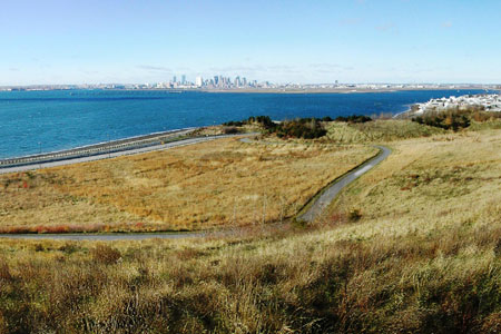
Deer Island Slope Site Near Boston

David sent this in from The Granite Glider Guiders a southern New Hampshire area club.

Deer Island is just minutes from downtown Boston and offers both east and west facing slopes. The property is part of the Boston Harbor Islands National Recreation Area. Public areas are open dawn to dusk every day. Using the address 175 Tafts Ave., Winthrop, MA 02152 will get you close.  The parking area is at the end of Tafts Ave.
Read more

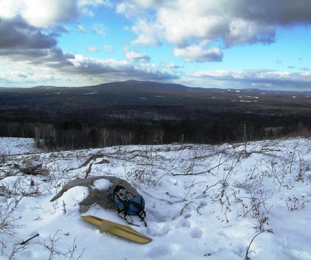
Berry Pasture Trail New Hampshire Slope Site

Berry Pasture Trail has long been a popular hiking trail leading to Burton Peak on Temple Mountain in Sharon, NH. A timber harvest was completed during the summer of 2007 which provides great views of Mount Monadnock and some awesome soaring when winds are blowing from the southwest. Use the Google Map below to get driving directions to the parking area.

From the parking area it’s a strenuous 15-20 minute climb to the west facing slope site. Just follow the triangular blue blazes until you come to the clearing.

The site is accessible in winter, but Mountain Road is not plowed by the town.  Four wheel drive (along with common sense) is highly recommended when the road is covered in snow.

Continuing up Berry Pasture Trail leads to the summit of Burton Peak.  Near the top it meets up with the Wapack trail which is marked by yellow blazes.  Follow the trail uphill until you see the blue blazes break off to the left. When the wind is north-westerly this area probably provides much better lift.  However, it’s pretty tight and not for the faint of heart.

Here is a link to a Google map of the area.

Page Springs, Arizona Slope Flying Site

Jim Breen sent info about this slope soairng site in Arizona.

We have a site in Page Springs, AZ (about 15 miles southwest of Sedona). It’s not a big hill, but adequate for foamie wings like a Weasel Pro. From October through May we get our typical southwest wind in the mid day with 10-15 mph pretty frequently. We’ve had flights lasting 30 min. to an hour plus. The best part is you can drive up to the edge of the slope site, and park, get out and toss your plane. If the occassional retrival is necessary, you can walk down the hill with a little care without killing yourself. Foamies only, composits will die here due to poor landing conditions.

If you want directions, best to write to me as they are a little complicated. JB3310@gmail.com

The Big M Platteville, WI 09-03-07

I stopped at The Big M in Platteville, WI today on the way home from the LEG Slopefest in Kansas for a little more slope flying. Can’t get enough! No one else there. Pretty decent conditions in the air. Not so great on the road that leads to the top. It was pretty sketchy. There is a large rill at the last turn before the top that requires a slow crossing and then you are mired in soft gravel. I made it through in the slopeflyer Chrysler T&C but realize that I drive this van where 95% of 4-wheelers wouldn’t so I’d suggest 4WD for now.

There is a new concrete bench really close to the LZ that makes landing a bit tricky so I flew my Predator Bee to test the lift and to try some different approaches for landing. I tried a new approach to the left of the stairs and it worked pretty well.

This shot is from the top of the stairs. The new bench is on the left and permanent!
That is the old bench on the right.

After the Bee I got my newly tuned Skip Miller Slope (Mach Dart) out and ripped up the place. I’d already moved the CG WAY back from the original Mach Dart instructions and it was sitting about the middle of the rear bolt. After removing another 1/4 ounce in Kansas I think it is pretty near perfect. It did roll off on a tip when I got it really slow but this thing is supposed to be going fast so that shouldn’t be a problem.

The wind when i flew the Slope was 12MPH-15MPH and big thermals. There was pretty much lift everywhere and huge loops, screaming dives and multiple roll passes were a blast. I worked in some Cuban 8s, basic Split Ss and a fairly respectable snap roll. It is great having an excellent slope, good conditions and a sweet plane and not have to worry about anyone else in the air but, at the same time, flying with other guys is really what sloping is all about to me so after about an hour I packed up and finished my trip back to Milwaukee.

More bench pix.

From the deck


From the parking area

Northwestern New Mexico Sloping Near Chama

L.P. How sent in this site in he Northwestern corner of New Mexico just outside of Chama.

He says  “Great landing area and my longest flight so far is over an hour with my Philip 600 e-powered hotliner. In the fall the color is beautiful not to mention surprising the train buffs with an airshow at one of the most beautiful spot in NM.

L.P. How sent in this site in he Northwestern corner of New Mexico just outside of Chama.

Directions:

  • Go north after Chama to Cumbre pass.
  • At the top there is a narrow gauge tour train stop.
  • Right after the pass, take the first left on to a dirt road and another left right away. (going behind the train station) 50~70 yards later you’ll see a hiking trail going up the saddle on your right. (if you get to the underpass, you’ve gone too far).
  • A short/easy 5 minute hike and you are there.

2007-08-04Great landing area and my longest flight so far is over an hour with my Philip 600 e-powered hotliner. In the fall the color is beautiful not to mention surprising the train buffs with an airshow at one of the most beautiful spot in NM.

I made the trip to fly up there from Santa Fe, which is a two hour drive, about four times.

Conditions had been winds 15~20 mph and when it isn’t blowing the thermal from the valley is just fantastic. I am not sure but I think on top of the pass is 10,500ft.

Get in touch with me if anyone is interested. antero@aol.com


Cape Cod Slope Soaring at Wellfleet Parking Issues

Jan sent in this update. IMPORTANT INFO HERE!

Meant to write you last summer after reading your Wellfleet parking paragraph. Things have become even more restrictive since 2007. In May 2008 my friend was flying at Duck Harbor when the National Seashore environmental ranger told him to cease flying because of endangered species (piping plover) nesting on the beach below. While we used to park at the Great Island parking lot, and walk to the slope, it is no longer possible to use this slope in the summer (mid May to Labor Day). Same goes for other Cape beaches – depends on nesting site location.

Here’s the thread from RC Groups – http://www.rcgroups.com/forums/showthread.php?t=870844&highlight=piping+plover

I have been to Cape Cod a couple of times before and have checked out a few of the slope soaring spots listed on the CRRC site that Helmet wrote a few years back. I’ve always had excellent flying while staying at the Seascape and hitting a few of the local hills. This year the wind was a bit more west on Thursday so I decided to try the dunes at Duck Harbor near Wellfleet.

Seems that the city of Wellfleet owns the beach at Duck Harbor and from the third Saturday in June to Labor Day will not issue a beach parking permit to anyone not staying in Wellfleet. I am staying in North Truro and so can not get  a legal pass to the beach during the day. After 5PM there are no restrictions but knowing about the restrictions earlier in the day would have saved me some time.

By the way, if you are staying in Wellfleet and looking for the place to get a parking pass just go to the harbor and check in at the Beach Parking Permit House.

Cape Cod Slope Soaring at the Seascape Motel

I got to the Seascape about 2PM on Wednesday, June 20th, 2007 and had a good hour of slope flying the Weasel and the Bee but the wind died off as the rain that had been in the area all morning passed.

I took a drive to look over Duck Harbor about 5PM and sloped the small dunes to the right as you walk up to the beach with my Polecat XP-4 DLG while Syd, Garrett  and Wendy hunted for shells. There are some roped off areas for the Plover nesting grounds to the left and I did not walk further to check out the higher dunes there as the wind was light. May check that area on Thursday if the 20kph West winds arrive.

Thursday was supposed to be West winds so I took a drive with the family over to Wellfleet and Duck Harbor. After 30 minutes or so of searching for the place to buy a parking permit for the beach we were thwarted by the City of Wellfleet and their Summer Beach Parking Pass Policy or SBPPP. Seems from the 3rd Saturday of June through Labor Day the city only issues parking passes to residents and guests of the city proper. Since we were staying in North Truro we did not rate a parking permit at any cost! I haven’t confirmed it yet but the parking people in Wellfleet informed me that Corn Hill in the City or Truro has the same policy, only for Truro residents and guests.
Read more

Indiana Dunes – Mt Baldy Weather Information

http://www.glerl.noaa.gov/metdata/mcy/

Here is a link to the Michigan city light house weather station for slope
soaring Mount Baldy.

As described before N-NW winds are ideal. Western southerly winds are soarable on the smaller north dune.

The large central bowl of the dune makes this site great for beginners to
learn with elbow room for mistakes.

I paraglide and RC this location whenever the winds permit.

Wally

Kepp’s Crossing Overlook Slope Site – Idaho Slope Soaring Site

Kepp’s Crossing Overlook Slope Site

Cory sent in this great report on a slope soaring spot in Southeast Idaho. He says Idaho Falls is at the eastern end of the Snake River Plain. This plain is oriented generally in line with the jet stream in spring and fall, which helps produce our winds.

Southeast Idaho has a reputation amongst its residents for being pretty windy. I’ve lived here for 29 years and always thought so too, that is until I took up slope flying in the early ‘90’s. Sometimes it seems like the wind only blows when all of my planes need repairs. Murphy must have been a sloper!  Seriously, I once knew someone who moved here from “The Windy City” who claimed that Chicago was calm compared to here.

Idaho Falls is at the eastern end of the Snake River Plain. This plain is oriented generally in line with the jet stream in spring and fall, which helps produce our winds. Unfortunately, most of the steeper slopes in our area do not face the prevailing wind direction of SSW.  Fortunately there are several exceptions. I will submit descriptions of these sites as I fly them this spring.

This part of the cliff makes the best lift.

Read more

Mt Baldy Slope Flying, Michigan City, Indiana Update

I have spent the last 2 afternoons sloping at Mt. Baldy near Michigan City IN. There are a lot of changes this year that slopers may want to take note of.

The first change is that the approach paths have been altered. The main (and only) path to the summit now begins at the service road on the west side of the main driveway entering the site. The result is a longer path to the top. The natural movement of the dune over the last couple of years has made the final approach to the summit a very steep one, so be advised to “keep it light” with the amount of stuff you carry with you.

Read more

San Antonio Mountain in Northern New Mexico

Posted by Ezra (Edited by Greg) on Mar 28, 2007, 21:35

San Antonio mountain, located on highway 285 about 10 miles south
of the Colorado state line, about 35 minutes northwest of Taos, New Mexico. A
massive blob with 10,000 foot altitude and 2100 feet above the surrounding is land located on BLM and Forest Land. There is a dirt road 87 that skirts the backside (southwest) where the winds are most prevelant. It’s size is deceiving, it’s about a mile hike from the car to the slope. The lift is massive, very easy to speck out my Kulbutan in any direction. The slope is rocky in some areas.
Read more

Diamond Ridge, Washington

Posted by Chris Erikson on Jul 16, 2006, 22:40

Diamond Ridge is a satisfying, easy to access slope 40 minutes north of the Hood River area of the Columbia Gorge. The moderately open face of the slope and sub-alpine character of the trees and meadow can be rewarding to fly, and when the wind is working, the smooth, powerful, enormous air characteristic of Gorge area slopes emerges.

Read more

Buena Vista, Newark, Licking County

80 feet, bowl

Driving Directions-Exit I-70 onto northbound Buena Vista Street.  Drive north until the slope opens up on your left.  Park at the north end on a public parking lot.

Wind Directions-West to South-Southwest.

Landing Zone-pretty decent, but with a strong rotor near the lip of the slope.  If necessary, go high and fly east across Buena Vista Street and land in the farm field.

Hazards-metal guardrail at the lip of the slope

Access-public park land.  Be considerate.

Map Link http://topozone.com/map.asp?z=17&n=4436400&e=381023&s=25&size=l&datum=nad83&layer=DRG25

Buck Creek State Park, CJ Brown Lake, Clark County – Slope Flying Site

Buck Creek State Park,  CJ Brown Lake, Clark County

This slope flying site is a 75 foot grassy dam face in a State Park.

(note from the editor: Dam faces often work great for DS give this one a go in East wings and let us know how it goes!)

Driving Directions – From I-70 exit onto US Route 40 just east of Springfield. Go about two miles west on Rt. 40, and then turn north on Bird Road. Follow Bird Road into Buck Creek State Park, drive along the south side of the lake, and then follow the signs  around to the park headquarters

Read more

Crane Mountain, Oregon

Crane Mtn, OR
Copyright Chris Erikson 2005

Location: 10 miles SSE of Lakeview, OR

Coordinates: (NAD83 / WGS84 datum)
N42.0743
W120.24388

Wind: SW to NW

Weather:
http://www.weatherunderground.com/US/OR/Lakeview.html

Terraserver:
http://www.terraserverusa.com/image.aspx?T=2&S=11&Z=10&X=1820&Y=11654&W=2&qs=%7clakeview%7c%7c

Ready to launch, view to South

Access: Dirt Road, medium clearance, rocky

Season: June to mid October, limited by snowpack

Vertical Relief: 4000’+

Skill level: High Intermediate

Background: Crane Mtn is a former lookout site at 8347′ in south central Oregon, a few miles from Lakeview. This enormous ridge consists of a single narrow ridgeline at least 2000′ taller than the surrounding peaks. The ridge runs nearly perfectly north to south and the flying site is located at it’s northern terminus.

Read more

Timberwolf Mountain, Washington

Posted by Chris Erikson on Sep 17, 2005, 15:45

Chris Erikson is back with another great slope in Washington. Timberwolf Mountain is a beautiful alpine slope located at the site of a former fire lookout at 6391′. This slope offers extremely vertical lift with the correct wind direction, unbeatable views of Mt Rainier directly to the west….and very challenging terrain if you wind up down the hill. The site is 32 miles WNW of Yakima, 8 miles N of Rimrock Lake.

Read more

My Weekend at Glider Point

Eric Hvinden sent in this story.

My Weekend at Glider Point

Having previously been hooked by the slope flying bug, I had gotten away from flying after an incident several years ago involving R/C Sailplanes, Pellet Guns and a Homeowners association. Needless to say, I needed a new place to fly. Living in Southern California, with the building of new homes occurring at an all time rate, and flying sites being bulldozed, I looked for a place that was relatively close, relatively accessible, and fun to fly. Looking on the Internet, I found Glider Point in Chino Hills State Park. It is located in the Chino Hills State Park, but access is from a residential neighborhood, where they have built homes right against the park boundary. The residential neighborhood has posted signs of no parking from 7PM to 8AM. The park officially closes at dusk, but the parking is only allowed until 7PM (A problem in Summer hours).
Read more

Slope at West Rock Park in West Haven Connecticut

Bill sent in another Connecticut slope. This one in West Haven.

I have another one that is unbelievable, and I am quite suprised that I seem to have “discovered” it. It is at West Rock in West Haven CT. West Rock is a delapidated park that nobody goes to. Most people go to East Rock to gawk at the city below. West Rock is a southwest facing cliff, over looking West Haven with a large open parking lot that has suprisingly smooth air to land. I had a combination of nice slope air and old fashioned lift from the city below, specked out easily. The cliff face has to be about 2 to 300 feet high, with little obstruction from trees. The day I flew I was able to drive my car right up to the top, but I hear that the park is suppose to be closed and cars are usually parked at the bottom when the gate is closed. I will look into that.

Looking at West Rock Park from the bottom
Launch area
The parking lot at the top


Slope Site Near Mohave Valley, Arizona

Tom Chant sent us this story about a slope soaring site near Mohave Valley, Arizona.

I live just south of Laughlin, Nevada in the fast growing area called Mohave Valley, AZ. we are about 115 miles southeast of Las Vegas, NV.

Since moving here in 2002 I have found many slope sites as the wind only blows twice a year in this area, 6 months from the north and 6 months from the south.

This spring I was at an inter-club fun fly at Kingman, AZ. We stopped flying the gassers for lunch and the Kingman group fed us burgers and hot dogs with all the trimmings and comforts of home. While sitting at lunch I happened to try to explain the fun of slope flying to some of my gasser buddies. They were somewhat interested and one of the wives spoke up and said that she had just the spot for that kind of thing!!! Well, I listened and she gave very precise directions to a Department of the Interior US Forest campground that had recently had a fine road built to give better public access.

I found the location that afternoon and it is spectacular!! to say the least, the hill is at 6700 ft. above sea level so it gives a cool spot for summer flying.

Stop it! How do you get there! Well first you have to dream, then you have to pray, and then be willing.

Take Hwy 93 north from Golden Valley of Kingman toward the Hoover Dam and Vegas, go past the turnoff to the town of Chloride about 1.5 miles to Big Wash Road, turn right 11 miles to Windy Point Recreation Area, the road continues onto Cherum peak. The road near the Windy Point has been great with the southwest wind of spring and summer and the campground is great with a north wind.

I am always available to fly. If you are in Vegas or on the river at Laughlin give me, Tom Chant, a call and put this location on the site locator.
Home 928-788-0335
Cell 928-542-5167

If you are in Vegas and are headed here take Boulder Hwy to Hoover Dam, cross the dam go about 70 miles to Big Wash Rd. turn left go 11 miles on the dirt road, the dirt road is well maintained and any two wheel drive car can make it without any problems.

One thing I missed is the campground has restrooms fire rings picnic tables area for tent camping and RV s have fun and call me if you come up.

I remember this story that the guy that sold me my home, he said that I was going to have all my toys and no one to play with, well I am having too much fun to worry about you guys but come, hang out, have fun and fly a great site in northwest AZ.

Cape Blanco State Park

Made famous in such classic soaring videos as Lift Ticket this is a great spot on the coast of Oregon. There is a DS groove here and pilots from all over attend several events each year.

For those on a family vacation (like your humble webmaster in the Spring of 2002!) you can check out the Cape Blance Lighthouse and other area attractions. See the Oregon State Parks website for more info.

http://www.oregonstateparks.org

Directions: The flying site is located at Cape Blanco State Park in southern Oregon. It is located 8 miles north of Port Orford, one hour south of Coos Bay, and 5 miles west off of Hwy 101. Check the club site at: http://www.clubsos.itgo.com

Allan’s NoCal Site in Sonoma County

Allan Carstensen sent in this story.

Hi Greg. I noticed that you don’t have many flying sites listed in Northern California. Well I’ve got a great site for you. I’m usually the only RC’er there and once in a while I get to fly along with an occasional hang glider or paraglider, as well as hawks, osprey and gulls.

The spot is Goat Rock State Park on the Sonoma County coastline, where the Russian River empties into the Pacific. You can fly in winds from  the north-west to the south.

Read more

Bear Tooth Highway West Summit, 10,947 feet!

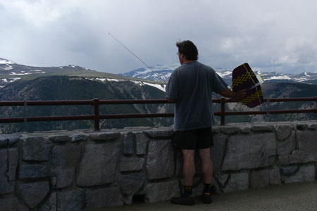
beartooth slope photo The West Summit of the Bear Tooth Pass is at 10,947 feet. What a view! Actually, everything from this point is down so slopes exist all over. The two I flew were just a couple of the many available.

Site one
At the sign for the West Summit there is a turnoff and parking area. On the day I was there the wind was westerly and I just walked a bit away from the parking lot and tossed the Weasel. It flew great. The slope at this point is not really steep but the Weasel made the most of the site. If I ranged farther over the road there was a terrific elevator of lift and at times I wondered if I could get the little Weasel down!
Read more

Idaho Slope Flying Site

David sent in this report. He is in Rexburg, in eastern Idaho. North of Idaho Falls.

Here is his report on a nice slope on public (BLM) land. It’s a bit of a trek on unmaintained dirt roads, so you’ll need a vehicle with good ground clearance. I go in my Chevy Astro van, but I bottom out sometimes. Better in a truck.

photo by Lynn Johnson

The slope has very nice south/southwest exposure, which is in the direction of the prevailing winds. There is also an adjacent bowl, from which you could do anything from straight west, through south, to right east. No northern exposure.
Read more

Beartooth Pass Montana Slope Spot, Rock Creek Vista

Whenever I am out west on vacation I usually find a way to get to Beartooth Pass. The road between Red Lodge, Montana and the NE gate of Yellowstone Park. On this trip I had several slope planes along and tried several slope spots on the drive. This one describes the Rock Creek Vista overlook.

Heading out of Read Lodge take US Hwy 212 up towards Bear Tooth Pass. This is one of the most scenic drives in the entire United States and would be worth the drive even if it were not for the many slope flying opportunities that are presented along the way. Venerable CBS newsman, Charles Kuralt has called this road “America’s most beautiful highway.”

Read more

Washington Slope 90 Minutes from Portland

McKinnley Ridge in Southwestern Washington

This fine flying site is located in Southwestern Washington. The site features relatively easy road access, great lift, and decent landing zones. The ridge can be flown in west or east winds, although I personally prefer winds from the east at this location. The east side of the ridge has less trees and more open terrain upwind of the slope.  And when flying in an east wind, the sun is at your back instead of in your eyes all afternoon. Although I haven’t explored it, I would think there would be good potential for dynamic soaring here. The top of the ridge is rather sharp in places, which can set up quite a rotor.

Read more

McKinnley Ridge in Southwestern Washington

Posted by Eric Molstead on Apr 26, 2004, 22:56

This fine flying site is located in Southwestern Washington. The site features relatively easy road access, great lift, and decent landing zones. The ridge can be flown in west or east winds, although I personally prefer winds from the east at this location.

This fine flying site is located in Southwestern Washington. The site features relatively easy road access, great lift, and decent landing zones. The ridge can be flown in west or east winds, although I personally prefer winds from the east at this location. The east side of the ridge has less trees and more open terrain upwind of the slope.  And when flying in an east wind, the sun is at your back instead of in your eyes all afternoon. Although I haven’t explored it, I would think there would be good potential for dynamic soaring here. The top of the ridge is rather sharp in places, which can set up quite a rotor.
Read more

Glen Rose soaring site

Glen Rose, TX, is a small town roughly between nowhere and nothing, west of Waco and SW of Dallas, and Dinosaur Valley State Park is just outside of Glen Rose.  I found a nice slope inside the park overlooking a graceful bend in the Paluxy River that faces roughly SE to SW, with most of the slope facing due south.

The frontside of the slope is covered in mountain juniper, but has a few holes where you can see out and land.  A trail runs up the ridge and requires a crossing of the river from the parking area, but this shouldn’t be a problem unless the water level is quite high.
Read more

Badger Mountian Washington

Badger Mountian Washington Sunday March 14, 2004

One of my favorite Slope soaring sites, about 20 minutes from downtown East Wenatchee, Washington, just a few miles from the site Clyde Pangborn and Hugh Herndon bellie landed the “Miss Veedol” after the first nonstop Transpacific flight, october 5th 1931.

The site is located to the north of a Radio Transmission site on Badger Mountain about 9 miles east of the town East Wenatchee, WA.

Read more

Two More Slopes Near Houghton

I found two more great slopes near Houghton, MI

1. East facing slope near WalMart. This slope is about 200 ft high. It faces the highway that goes south from here (US 29 ) (Taco Bell, Walmart etc.). The top of the slope is occupied by “The Bluffs” an apartment complex for retirement-age folks. Between the apartment building and the slope is a paved trail (maybe for jogging and biking). There was no indication of who owns the trail and no “no trespassing” signs. The slope of the slope is maybe 45 degrees. There is a gravel access road about 75 ft down the slope accessible from the north. This road is marked “private property” but it doesn’t say “no trespassing”. Presently, whoever manages the slope had put a geo-fabric and grass on it and is watering it in the hopes that the grass will prevent erosion. I went there one day to test the air. A wind which was easterly 10 mph on the flat was turned into a 25 mph gale on the slope. I have never flown my gliders in such a wind, so I didn’t try it.

2. The other slope faces west, which is the direction of the prevailing winds here. This slope is just east of Superior Sand and Gravel. The location is just outside of the west end of Hancock Michigan. Superior Sand and Gravel occupies the base of the hill. On top of the hill is the Houghton County Arena and Fairgrounds. The slope is between the two. A high tension power line runs nearly parallel to the slope. The land just in from the top of the slope is maybe a jogging/nordic skiing trail area. You can drive/follow trails to the lip of the slope. This slope must be about 200 ft high. I have not been there when the wind is blowing. Again, I need to practice on smaller slopes before throwing my airplane of this one.

I asked at Superior Sand and Gravel about flying there. They didn’t seem to mind. I must say that there is a certain element of danger with that high cliff.

Also, there is a site near Eagle Harbor which looks good for thermal flying. It is waste basalt sand from a former copper mining operation. It may be reached by driving south past the Eagle Harbor cemetery and continuing more or less south for 2.5 miles. The site is privately owned but there are no “no trespassing” signs. There is a cable across the road but it may be just lifted off the post. The site is pretty much flat and is maybe 800 by 800 ft. (~ 16 acres). Unfortunately, it is also sometimes  a playground for people with two, three or four wheel bikes. A dozen or so of them came by when I was trying to fly, and I was quite concerned about them running over my airplane or tangling my high start.

Chuck Young

Massachusetts Slope Site in the Berkshires

Here’s a great slope site in Mass, The Mohawk Trail. 800 vertical feet high at least. West facing slope and the wind is always west here.

Here’s a panoramic shot.

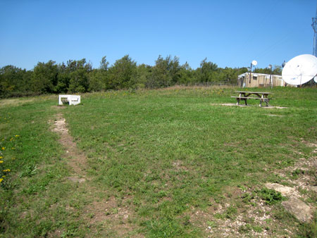
The spot is the western most summit of the Mohawk Trail,  Heading out of North Adams follow RT.2  East – after a short drive up the mountain you will come to the Deadman’s curve “almost a 360 degree turn, then up another long ascent. At the very top of that first summit is a gift shop, directly across the street on that corner is a small dirt road. Down the dirt road 50 yards park next to the large antenna and radio shack, follow the trail in back of the shack to the launching site. 800 vertical feet below you, always a strong west wind. Tough landing EPP slopers  recommended.

Sloping at Sentinel Gap (Saddle Mtn West)

Posted by Chris Erikson on Oct 26, 2003, 15:35


The Sentinel Gap slope site is on the extreme west end of Saddle mountain, overlooking the Columbia river. It is easily the most spectacular flying site on the Saddle mountain complex, quite a statement for an isolated mountain known for it’s incredible views and the expansive scenery at every site.

Copyright Chris Erikson 2003

Location: Central Washington, 20 Miles SW of Moses lake


Driving Time: 2.5 hours from Seattle

Read more

Slope Soaring Near Birmingham

Jim Larkin sent us this story from Birmingham. Thanks, Jim!

We have a slope here in Birmingham, AL, but only for NW winds or something very close. It is a cleared off mountain top that homes are being built on. Construction presently stopped due to some fill dirt settling and some cracks have resulted. So, we can fly for a while. The name of the site is The Ledges of Weatherly and is south of Birmingham, in the Pelham area.

We don’t get much NW, mostly when we have a weather change. Usually pretty turbulent so we fly mostly foamies.

Slope Flying at Cadillac Mountain

I was on vacation in Maine with my family where we made the trip from Bangor to Acadia National Park and Bar Harbor for some sight seeing and some flying at Cadillac Mountain.

I flew the Combat Wings XL at the Blue Mountain Overlook just below the summit of Cadillac Mountain. The wind was coming in at about 15 and just slightly right. I launched just in front of the parking lot and found the lift a bit choppy in close so I headed further out and the lift became much smoother and was nice and strong. I think any plane would have flown there today but I would suggest being very familiar with any crunchy so you can hand catch it. The LZ is either solid granite or very thick brush, so I chose the brush.

Texas Slope Sites in Travis County

Texas -Travis county (about 5 miles west of Austin.)

Mansfield Dam.

Off of 620, a few miles south of 620 and 2222. 30 deg 23.672′ N and 97 deg 54.538′ W, at an altitude of 751 feet.

We fly out of the parking lot at the north-west side of the dam. It’s good in south to south west winds, and the dam itself also creates some good thermals, so you can fly with no wind if you have a light  enough plane.

Note that this isn’t a good place for beginners, or for combat, or for planes that aren’t reliable. If your plane goes down, it could easily go down in tall trees, rugged terrain, on the dam itself (which is closed due to 9/11 paranoia) or even in the water. Also, if you don’t get any lift right after your first throw, you’re not likely to be able to bring your plane back. So until you get a feel for the place, I suggest flying an electric plane (Zagi 400x works well, and will slope with no motor use in 5-10 mph), or a floater with a hi-start (giving you plenty of altitude to work with.)

You can get an idea of the weather there, here:

http://www.kvue.com/images/liveimages/travis.jpg

Read more

Cape Cod Sloping June 23rd to 27th

We arrived at the Seascape Motel on Monday evening after an 8-hour drive from Philly. I checked in, unloaded the family and the car and stepped out the ocean side door to behold a beautiful sight. The 80-foot (give or take a few feet) slope about 20 steps from my door. There was a light SW breeze coming in and a lazy 30-minute flight with the Cyberdyne DLG was just what the doctor ordered after the drive to get here. The poly Cyberdyne makes a good sloper in light air.

Tuesday started out with a very light wind so the family and I went on a whale-watching trip on the Portuguese Princess. We saw a couple of whales and my daughter, Sydney, loved it! One of the whales was a Finback and was about 60 foot long. It made several passes close to the boat. We also spent some time sluffing around Provincetown.
Read more

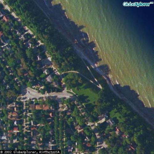
Big Bay Park, Whitefish Bay, WI

Big Bay Park, Whitefish Bay, WI

70 foot slope overlooking Lake michigan. Small, tricky landing area. 3 of us live within a mile of it!

Good bowl shaped slope on the shore of Lake Michigan a few miles north of Milwaukee. The slope is small, only about 70 feet but it provides good lift. The landing area is tricky and requires an up the face and plop it on the top approach. NNE to E winds, but if it gets East there are better slopes a bit south of here.
Read more

Wahatis Peak Slope Flying

Posted by Chris Erikson on Apr 12, 2003

Chris has done it again. An excellent description of what looks like a great slope called Wahatis Peak located in central Washington on the Columbia Plateau, about 9 miles S of Vantage.

Wahatis Peak (Saddle Mtn East)

Copyright Chris Erikson 2003

Location: Central Washington, 20 Miles SW of Moses lake

Driving Time: 3.5 hours from Seattle

Read more

Spectacular Sunday at the Big M!

Mirko writes: This WAS one of the best days we ever had on any slope!  It was no effort to climb out to 1000 ft at anytime of the day.  Steady 25-30 mph winds, with over  twenty different planes flying.  Two different Compact Wizard 2X, four different Pixels,  an Ellipse 3 CAM, Extreme, Psycho, Jedi, Hornisse, Fitness, and various trashy foamies.  There were only three of us: Greg, Ken Nelson and myself. This was Ken’s first time ever to the Mound: he was just thrilled with the great conditions.

With all the dry, unplanted dark ground in front of the Mound, super strong thermals were constantly blowing through the lift zone, which allowed straight out, forward flight to huge altitudes all day.  Very pleasant 70 F all day, with no clouds, until about 7:00 PM.  This was the dream come true slope day.  Best of all, no crashes or even, bad landings. The Wizards, Ellipse, Psycho, Jedi, and of course, the Pixels all were screaming like banshees.

Greg says: What a day! I have a new toy and it is not a plane. Have a look at the pix and you will see what it is!

All photos by Greg unless noted. (There is a second page of pix here)

Ken and his ballasted Bluto

Read more

I Stopped at Don’s Hobby Shop in Salina

I was at Wilson Lake for a few days and we headed over to Coronado Heights because the wind direction was better. While going through Salina we stopped at Don’s Hobby Shop. Nice place, super prices on JR gear and Don was a nice guy. Gliders are not really their thing but as far as hobby shops go it has all you might need if you run in to a repair situation and you are in the area.

Don’s Hobby Shop
1819 S. Broadway
Salina, KS 67401

Phone: 913-827-3222

The Slope at Bender Park – OakCreek, WI

Milwaukee Slope Flying Sites

SH-50 at Bender Park Oakwood Rd. location

Bender Park, Milwaukee

Good 100+ foot bluff on the shore of Lake Michigan NNE to SE winds with slightly NE best. The best slope in the Milwaukee area is in Oak Creek at the end of Fitzsimmons Road or Oakwood Road. The walk up Oakwood is much shorter! Huge landing area, no trees, 100+ ft slopes, but of course one huge problem: Milwaukee County has closed it. There is a gate across the road. The county government closed this to re-build the bluff north of Fitzsimmons Road for a now defunct golf course. If you do not mind a bit of a hike you can park at the Marina at the end of Ryan Rd., head south and climb from the bottom.
Read more

Slope Flying at Warnimont Park, Cudahy, WI

Posted by Greg Smith on Feb 24, 2003

Warnimont Park Slope Looking South from the Gun Club

Warnimont Park, Milwaukee, WI

This slope in southern Milwaukee County in Cudahy is 100 to 120 feet high. It is just behind the Cudahy High School. You can use the school football/athletic field across the street as a place to land. This slope is inside Warnimont Park just 4 or 5 blocks south of Layton Avenue.

The trap shooting site just south of here is also good. Both places work best in an Easterly wind.

Attention: There are a couple of alternate launch sites in this park, check them all before you launch!
Read more

Rampart Ridge Slope Soaring

Posted by Chris Erikson on Dec 30, 2002, 22:08


The Rampart ridge site is at 4600′ on the S end of Rampart Ridge on the edge of the Alpine Lakes Wilderness. This site is especially nice because of it’s close proximity to Seattle, which makes it ideal for daytrips and spur of the moment flying trips, but it also has a dicey landing zone, combined with outlanding terrain that can make a grown man cry like a little girl who’s lost her dolly

Rampart Ridge

Copyright Chris Erikson 2002


Location: 3 miles SE of Snoqualmie Pass summit

Driving Time: 1:15 hour from SR520 – I90 junction in Bellevue

Wind: NW to S to SE

Weather site: http://www.weatherunderground.com/US/WA/Stampede_Pass.html


Access: Drive to

Rampart Ridge looking south

Season: open from early July to Nov, access limited by snow pack


Background:

The Rampart ridge site is at 4600′ on the S end of Rampart Ridge on the edge of the Alpine Lakes Wilderness. This site is especially nice because of it’s close proximity to Seattle, which makes it ideal for daytrips and spur of the moment flying trips, but it also has a dicey landing zone, combined with outlanding terrain that can make a grown man cry like a little girl who’s lost her dolly.

That said, with a trimmed reliable plane and confident pilot, it’s a fine hill close to town. I have even gone up and flown for a few hours after work during long summer days. Great view of pass and a great view of Mt Rainier.

It can be a challenging place to fly, because while the lift can be very large, out landings are savage as described and the landing zone is in a large rotor if the lift is pumping. For these reasons this is a foamy or hand launch hill.

This site is also frequented by hang glider folks, as evidenced by the launch ramp visible in the photos. During the summer sharing the site with hang gliders is common, but usually the lift is large enough for them to run N along the rest of Rampart Ridge and they rarely remain in the immediate area RC pilots use.

Vertical Relief: 1600 feet

Rampart Ridge, flying site at center

Typical Weather:

NW winds are the most common due to it’s location near Snoqualmie pass which acts as a wind tunnel aimed directly at this slope. E and S wind are also flyable but typically more turbulent. During high pressure systems when wind swings in from the east, this is more of a light lift slope.  If high pressure is not present and weather is actually moving across the state, it’s most likely blowing W to NW here. Due to it’s proximity to the pass, rain can also be a problem.

Slope Terrain:

Extremely steep clearcut, old logging slash everywhere on the hill, interspersed with recently replanted 15 foot firs. The launch site is open and direct, but small trees here and there need attention if flying close to the deck. Pleasing knob with heather to sit on for flying the S and SE faces.


Flying:.

Lift always good in W to NW wind, often booming big as good as anything elsewhere. Can be smooth or extremely turbulent. Moderate lift is typical. Relatively limited ridge running but large lift band. There is a slightly higher site a few hundred feet north about a hundred feet higher with a S facing aspect. Good sight lines directly W and to the right (NW). If standing near the hang glider launch while flying, care is needed to avoid flying too low to the left, a plane can drop out of sight hidden by the small knob and the couple trees located there.

Landing zone:

Open approach area, with no tall obstructions. The landing zone is the gravel road. Rotor is large and go rounds when aiming for road are not easy because of the need to approach from the backside, where the road is 20 feet lower than the slope lip and if it’s not looking good it can be difficult to make it back out over the slope.

It is possible to ditch in patches of fireweed near the lip, but rotor makes this tricky while at the same time these patches are located for the cleanest go rounds due to their proximity to the lip.


Walk of Shame:

Probably the worst of all sites I’ve flown. Extremely steep logging slash chokes entire hill, and is threaded with sticker bushes. If the lift is good and your plane is flying well, you’ll probably be fine, but the penalty for mistakes is one you will not wish to repeat once you experience it for yourself. Tall brush is everywhere if you get more than a few hundred feet down, I’d recommend a beeper if you are not adept at locating downed planes.

Blowback landings when flying a W wind will typically wind up near the road, there are fewer stickers and it is not as steep, but many small trees impede visibility.


Camping:

Great campsite right behind upper slope site, just continue on road past primary site and take obvious left.

Road Conditions:

Lower portion of approach is paved leading to good gravel road, final couple miles extremely rocky, high clearance is necessary but 4 wheel drive is not.


Getting There:

Take I-90 E from Seattle to Snoqualmie pass, take Hyak/Gold Creek exit 54 about 2 miles E of the actual summit. Turn left and head N under freeway, then take right on Gold creek road, you will now parallel I-90 on it’s N side.

Continue 2 miles until road turns dirt, climb a few thousand feet in a couple miles and look for the second left at 3.5 miles (1.5 miles from beginning of dirt), off the second right hand switchback. There is a sign for the Mt Margaret trailhead at this corner, you do not wish to follow the sign, for us it merely indicates the correct corner for a leaving this stretch of road.

Continue on the side road for a couple miles watching for a left at 5.0 miles (3.0 miles of dirt), which will take you down across Rocky Run Creek. As you proceed you will see the road you want across the valley climbing a clear cut hill, you may even see cars already near the top.

Turn left as described, cross Rocky run creek and start up final approach. It will get very rocky for about a mile, then at a sharp left hand switchback it will get OK again and it’s only ¼ mile to the obvious flying site. It is located on a knob where the road makes a hard right turn, and is marked by the hang glider launch ramp. Total distance is 7 miles from turning onto Gold Creek road, 5 miles from beginning of dirt.

Contact Chris at mtngoat9@aol.com

Slope Flying Site Near Toledo – Maumee Bay State Park

This hill, in Maumee Bay State Park, was made from dirt piled out of the ponds made nearby. It rises 70 ft in the air. It is just 150 feet from Lake Erie, wind coming from the north is undisturbed as it comes across and produces some good lift. I have been sloping here, along with some others, for over a year now, and many have before me.

The best lift and sometimes the only spot you can find lift in light winds is produced from wind coming from the east, blowing up the steepest side. Then the greatest lift comes from wind blowing from the south, then the north, then the east. Although there are woods directly southwest of the hill, small lift is still produced with wind coming from that direction.
Read more

Sloping at Concordia University, Mequon, WI


Russ and his Shrike at Concordia


Concordia University, Mequon, WI

Concordia University is located in Mequon, 15 miles north of Milwaukee. This is an excellent site for East and SE winds. Landing is tricky due to many small trees and bad rotor in higher winds. But there is high grass to plow into if you have trouble with a long approach. A couple of foot paths can make nice approach paths.

Prodij and Mini-Acacia at Concordia 2-07-01
Photo: Greg Smit

Read more

Chumstick Mountain Slope Site


Chumstick Mountain

Chumstick Mtn is a former fire lookout at 5810′ elevation. This peak is one of the principal summits on the SE end of Entiat ridge with 1000+ vertical over immediate local terrain.

Posted by Chris Erikson on Oct 25, 2002, 23:43


Chumstick Mtn
Copyright Chris Erikson 2002

Location:
12 miles NE of Leavenworth, 10 miles N of Cashmere

Driving Time: about 3 hours from Seattle direct to summit. (once you have the dirt roads figured out)

Wind: NW to S to SE.

Weather site: Wenatchee

Access: Road direct to site, open mid July to late Oct due to snow.

Background: Chumstick Mtn is a former fire lookout at 5810′ elevation. This peak is one of the principal summits on the SE end of Entiat ridge, a large geographic structure composed of a single continuous ridgeline over 40 miles in length.

The flying site is directly on the summit of the peak, a pleasing open site with a nifty small flat top and a road ringing the summit. The N face is covered with small alpine trees but the flying side of the hill is completely open.
Read more

South Dakota Slope Trip September 2002

If you asked anyone that attended this last trip to Chamberlain you would hear what a great time we all had. The first two days of the trip we encountered overcast and occasional rain but the winds cooperated even on those days. By the third day the winds were blowing about 35mph (my guess) and the weather warmed up quite a bit. Sunday was warm and the winds were steady at about 15 to 20 mph, which made for great flying conditions.

About 25 people made the trip this year. Bill Grenoble and Rick Rensi drove all the way from PA to fly with us. Their van was packed with some great looking and flying models of all descriptions. Bill’s sense of humor added to the fun we were already having before we ever arrived in South Dakota. Back at the motel Bill and Rick both buzzed  the parking lot with their small electrics and made a few carrier landings (that’s what they said they were in an effort to save face) on the roof of the motel building.
Read more

South Dakota Slope Trip 2002 notes by Bill Kuhl

Ed Berris did a great job of describing the September slope trip to South Dakota, I just wanted to add a few comments and offer the digital pictures I had taken. This was my first sloping trip to South Dakota, but it will not be my last. Most of my sailplane flying has been thermal soaring, but I have a new appreciation of slope soaring after this trip.

Taking a trip like this, you have to look at the whole experience, not just the flying. All the things you learn, the camaraderie of being around other people with similar interests, and enjoying the outdoors, no matter what the weather is like. I picked up more soaring knowledge during the meals we shared, than reading a month of Soaring Exchange.

Emil and Larry had their JW’s in the DS grove together


Observing DS for the first time was a real treat. Watching it on video, makes it look much easier than it really is. Even the very experienced pilots were bashing the hill because their planes were caught in turbulence around the DS groove. I really have an appreciation of the durability and performance of the newer EPP slope planes, how these planes survive repeated crashes on the rocky slopes is beyond me. I joked with the guys, “Imagine if DS was discovered when everyone flew balsa sailplanes?”

As far as my flying, in three and a half days of slope flying, I must of accumulated more stick time than most power flyers in my local club put in during an entire season of flying. But, next trip I will have at least one JW for sure.

Read more

Central Coast Area – Sheboygan, Manitowac and Kewaunee

Central Wisconsin Coast Slope Flying Sites

The Kewaunee slope

Kewaunee is about 30 miles north of Manitowoc. There is a very good site on the lake just after the Marina. As you pass the Marina on HWY 42, turn right on Hathaway Drive and follow it to the stop sign. Turn left to go up the hill. At the top of the crest is probably the best place to fly; there is a decent landing area between the road and the bluff. This road is a ridge road for a while. Direction is East to ESE. The interesting twist here is that there is a west facing bluff less than 100 yards from the lake bluff. This could offer Dynamic Soaring possibilities whenever there is a west wind – or even when there is an East wind.
Read more

Sloping in Stoughton Wisconsin

Wisconsin Slope Flying Sites

Sand Hill Middle School- Stoughton WI
submitted by Clayton Greaves

Here’s my slope infected son, age 3, launching my Boomerang at Sand Hill Middle School. What form!!!! The slope is approximately 50′ above the cornfield with about a 30 degree grade. This site, 4 blocks from my home only works with West winds.

Best success here is with lightly loaded hand launch gliders such as my 11 ounce Monarch or 10 ounce Zagi THL to my favorite 15 ounce Boomerang. Before we owned lighter ships we found this site a challenge with 20+ ounce combat Zagis- even in the strongest winds. the foreground is a huge 3/4 mile flat corn field, so the lift band, though narrow, is quite clean.  Even in the best of conditions the lift here is only fair. Combat at this site is possible but would likely be marginal compared to other venues.

Directions: From Madison Take Hyway 51 ten miles south to county highway B. B is for bank- as you crest a hill and on the corner of B is.. you guessed it, a bank branch office out in the middle of hundreds of acres of corn fields.  Turn left and you will immediately see the slope a mile up the road on the right. Turn at the first Right turn, Lincoln Street. The second drive enters the school grounds, around the south side of the building and the slope site on the edge of this playground.

Have fun and impress you friends side slipping you plane between the row of basketball hoops. Balsa ships “need not apply” Be sure to search for lift off the north end of the building ( visible in the photo background).. the stone surface adds thermals in warm conditions.

Note that visits to this site would need to be limited to evenings and weekends so as to not interfere with school activities, kids drooling on the windows, missing class etc. The janitors have been very friendly and once lent an assist when my plane found it’s way onto the roof.

Where’d it go?

Local Pilots

Clayton Greaves

Sloping in Verona Wisconsin

Site Report: Badger Prairie Park, Verona WI
submitted by Clayton Greaves

This slope is adjacent to a gas model field atop the landfill shown in the photos I have attached. Thusly, if you want to befriend fellow modelers at the field it is good practice to stop by- let anybody know where you will be flying and post your frequency to the control board.

This aeromodeling field is administered by the Dane County Parks. An annual user permit is $12 from the parks office. Occasional users could of course pass on this expense and post your AMA card, but don’t say you heard that from me…

South winds are best at this marginal lift site. South Southeast works too but any further to the east and the adjacent highway overpass obstructs the approaching winds. I have a good picture of this area and the obstacles involved. Southwest winds are problematic due to a grove of trees right in front of the slope but due south has the wind coming straight up the hill cleanly. Early this year there was a 36-minute flight with a Boomerang wing. My personal best is about 22 minutes with my Monarch HLG. I recommend you leave the lead sleds in the car when you arrive here. I often profit from thermals here on warm days, the asphalt road ahead of the hill probably contributes to this.

Directions:

From Madison take 151 South about 6 miles to the first Verona exit. At the first stoplight the slope is too your immediate right and hard to miss. There is a frontage road along the south face that leads to the currently active section of the landfill. If the gate is open you can park right at the base of this 50ish foot hill slope. If not, park along the West side or in the lot at the aeromodeling field and walk out to the edge, about 100 yards. I consider this site marginal when compared to the Big M in Platteville but since this is an eight minute drive from my office it makes for a refreshing lunch break stop.

Local Pilots
Clayton Greaves

Base of the slope looking West.

View from the top. Road is due South, tree grove on the right creates turbulence in Southwest winds.

View East from the top. Too much East and this highway overpass comes into play.

Wisconsin Slope Flying Site near Black Earth

Wisconsin Slope Flying Site near Black Earth

by Clayton Greaves

Ceder Ridge Campground
is located 20 minutes drive from Madison’s West side on highway 78 midway between Black Earth WI and Prairie Du Sac Wi. 78 crosses US 14 a couple miles West of Black Earth, turn North on 78.

Below several pictures describing the approach from the south via Black Earth. Turn Right off Highway 78 to Dunlop Hollow Road approximately 5 miles up the road.

The images show the approch to the slope, road sign, the campground entry, the next shows the road up the back side of the slope and the final shot, with the cross is the slope site. If you look carefully at the approach shot the slope is visible in the background. Magnify and look for a white cross at the very top of the face of the hill…

This slope faces Southwest. Huge lift in 15+mph. South winds are blocked by a nearby hill. West winds are workable but increasingly challenging.due to obstructing trees and the lack of a west facing pilot position.

This is a foamy only site with very little margin for error on landing. The narrow landing area behind the pilot position at the cross is surrounded by high trees. In strong winds you fly over the top and drop down in the campsite behind. Hairy stuff, especially for the uninitiated.

Camping is available though primitive. The owner welcomes glider fliers and there is a camp fee box at the entrance shack where I drop a $5 bill as I pass. Rarely do I see any sign of life at the gate.

The area is infamous for its proliferation of folks of, shall we say “alternative” sexual orientation- Mazomanie nude beach overflow is my theory here…Overnighting at Cedar Hills is not high on my “adventure meter”, though the idea of awaking and immediately stepping out onto a slope is quite appealing.

The solid granite faces of the hill are rugged going when descending to claim a downed plane… beepers pay off here. I once hit the stone, nose in, “full tilt boogie” in combat with my original Zagi LE. The wing bounced several feet, rolled inverted, wabbled and continued to fly away… Amazing and memorable stuff. Pine trees around the crest provide cover from falling (plane) debris – kind of… In a head on collision my wing went belly to the wind and charged back at us and through the pilot position it impacted a tree at a dangerously high rate of speed and feet from my startled opponent–“crunch, splinter” .. ” I planned that”. The evergreen in question is to the right in the cross photo. This is the best and relatively safest place to stand. There is a nice swing out there on the corner but the best seat is right on the stone face, feet dangling over in the wind.

Plan dinner or cocktails at the new Rookies restaurant at the 14 and 78 intersection, then go buy rock climbing shoes at the famous and prolific Shoe Box shoe store in Black Earth a mile East. Both local landmarks are owned by the same fellow.

Cedar Hills fills a role for Madison slope- a- holics who for need of time or spousal leave- can’t make time to trek long distance to Platteville. Despite the challenges in landing this site can be huge fun in favorable wind conditions. Leave your balsa and composite ships at home, bring a foamie and someone to chase.

Local Pilots

Clayton Greaves

Slope Flying at Theresa Marsh

Theresa Marsh Slope Flying SiteMirko Bodul

Go up past West Bend on HWY 41.
About 7-8 miles past HWY 33, exit on HWY 28.
Go left (west) on HWY 28 for about 0.5 miles, take the first road left AFTER the HWY entrance and follow it. It is called Mohawk Road and snakes around for awhile (1 mile?) finally heads east with Theresa Marsh on the right dropping off gently.

I usually fly from the highest point to the left of the great big, brown sign, indicating that this is Theresa Marsh, wildlife refuge. Others preferred parking in the small lot a little lower and flying from there. Take your pick.

However, to the north of this road on top of this site is a cornfield, with electric or phone wires at the start of this field. If you climb up the embankment you can see how much that drops off to the north. If this is enough of a drop, I would launch to the south, from under the wires and work my way up with the plane and eventually walk north to an optimum spot for DS.

Let’s hope this does drop enough. With South and SSW winds some very good flying can be done here. I have attained huge altitudes here due to a thermal “kick” that comes in with the slope air. But be forewarned that this is not a “smooth” site: flying under 200 feet can be very bumpy.

Local Pilots

Mirko Bodul

Greg Smith

Slope Soaring at Ludington, Michigan

These are locations we have had the privilege to fly. Some may have access restrictions.
Check with local flyers for information.

Michigan Slope Flying Sites

Sloping at Ludington, MI

Ludington Michigan is named after a 19th Century timber baron who sited the town at the estuary of the Pere Marquette River on the shores of Lake Michigan, just about halfway between the Indiana border and the Sioux. It was the logical place for James Ludington to set up a railroad and wagon ferry across Lake Michigan to Manitowoc Wisconsin, and the steamer still runs today.

Ludington is not nearly as touristy as Leland Michigan, but it does boast several very nice restaurants, a swarm of Victorian Bed and Breakfasts, and a beautiful Romanesque red sandstone courthouse. Also worth a visit is the Pere Marquette National Scenic River. There is plenty of opportunity for lake and river recreation in the area.
Read more

Slope Flying at Sleeping Bear Dunes, Empire, Michigan

Sleeping Bear Dunes National Lakeshore – Empire Michigan

Located in Northwestern, Lower Michigan Sleeping Bear is about 25 miles Southwest of Traverse City, MI. The National Lakeshore encompases a lot of area and there are many dunes from which to fly. Explore a bit! Pyramid Point near Glen Arbor is over 500 feet above Lake Michigan!

The following is courtesy of Tom Nagle from Columbus, OH:

Read more

Minnesota Slope Flying in Red Wing


Red Wing, MN

Located about 40 miles south of Minneapolis/St.Paul, MN in the Mississippi river valley. It is quite hilly in the area with most bluffs topping out around 300′ above the valley floor. Red Wing is a quaint little town with several antique shops and an 18-mile beautiful paved bike trail. It is very popular with bikers and skaters on the weekends.

Barns Bluff
The hill I like to fly is called “Barns Bluff” and is located right on the north end of town. It is approximately a mile long and tops out at 300′ according to my Cateye Altimeter bike computer. The hill is 90% open on the south face and requires a South to Southwest wind from 12mph to stay aloft. The bluff is very steep and even has some rock ledges you want to stay away from unless you’re rock climbing. The North side of the bluff is even steeper but completely covered with trees. If it were open, this would be one heck of a Dynamic Soaring site as the top comes to a very sharp point.
Read more

Virginia Sloping in Bristol at Sugar Hollow Park

Virginia Slope Flying Sites

Bristol, VA – Sugar Hollow Park
The park has a man-made dike that is very flyable. Facing southeast, the dike is about 120′ high and at least 300′ wide, with a 20′ flat area on top before descending about 50′ down the back. Maybe there is some DS potential here, I never tried it myself! Only flew there once, very clean and smooth lift with 10-15 mph wind easily lofted my Zagi to “thumbnail” size.

Notice that hikers share the top of the dike as part of a hiking trail, so choose your landing area carefully! As of 12/26/01, there was no water behind the dike.

Read more

Sloping in New Mexico near Bernalillo


New Mexico Slope Flying Sites
submitted by Richard in Albuquerque

Jemez River Dam
Location approx 3-5 mi N of Bernalillo, NM.  A lava mesa suitable for flying foamies and other disposable aircraft in S to WNW winds. Top of cliff is about 150 ft above reservoir. Wear sturdy boots or hiking shoes in the event a retrieval is necessary. Best wind conditions are January thru April. Beware of the very nasty rotor!! Be sure to bring extra strapping tape.

Detailed directions: Take I-25 to exit 242. Go W on Hiway 550 to the intersection of NM528 just past the Santa Ana Star Casino. Turn N on hiway and continue past the Santa Ana Golf Course. Continue straight for several miles to Jemez Canyon Dam, an Army Corp. of Engineers project. At the end of the road is a picnic area. All along the west and south facing cliff is flyable.  One caveat–the mesa is Santa Ana Pueblo land–it may be off-limits during Pueblo religious activities and driving off of the paved road to the south face may be prohibited (depending upon who you talk to). More details can be found at:
http://www.slopecombat.freeservers.com/custom2.html

A topo map of the area can be found at:
http://topozone.com/map.asp?z=13&n=3916822&e=359461&s=25

Local Pilots

Richard Shagam

These are locations we have had the privilege to fly. Some may have access restrictions.
Check with local flyers for information.

Slope flying at Jockey’s Ridge, Nags Head, NC


North Carolina Slope Flying Sites

Jockey’s Ridge is a big sand dune that is just off 158, which is the main bypass thru Nag’s Head. It is hard to miss as it is the highest point around.

On the day I was there the wind was about 15-18 mph out of the northeast. I had been flying the SH-50 for about 1/2 hour when Tom from Richmond, VA showed up to fly his Chrysalis. Tom mentioned that the wind direction we had was more like fall wind but not unheard of in July. He said that mid to late fall have more days with useable wind.

The hill had quite a few people on it but there was plenty of space to use. The kite fliers were on the bottom or back of the hill and the hang gliders never got above the crest.

These are locations we have had the privilege to fly. Some may have access restrictions.
Check with local flyers for information.

Scroll To Top
Skip to toolbar