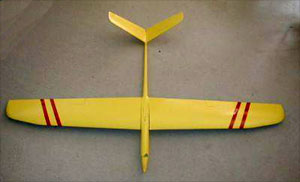
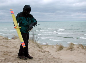
Posted by Chris Erikson on Dec 30, 2002, 22:08
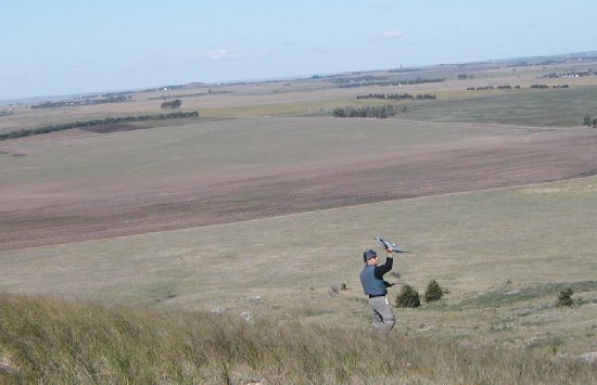
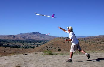
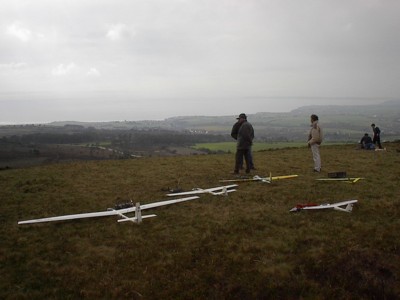
The Rampart ridge site is at 4600′ on the S end of Rampart Ridge on the edge of the Alpine Lakes Wilderness. This site is especially nice because of it’s close proximity to Seattle, which makes it ideal for daytrips and spur of the moment flying trips, but it also has a dicey landing zone, combined with outlanding terrain that can make a grown man cry like a little girl who’s lost her dolly
Rampart Ridge
Copyright Chris Erikson 2002
Location: 3 miles SE of Snoqualmie Pass summit
Driving Time: 1:15 hour from SR520 – I90 junction in Bellevue
Wind: NW to S to SE
Weather site: http://www.weatherunderground.com/US/WA/Stampede_Pass.html
Access: Drive to
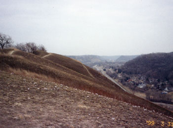
 |
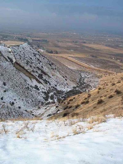
| Rampart Ridge looking south |
Season: open from early July to Nov, access limited by snow pack
Background:
The Rampart ridge site is at 4600′ on the S end of Rampart Ridge on the edge of the Alpine Lakes Wilderness. This site is especially nice because of it’s close proximity to Seattle, which makes it ideal for daytrips and spur of the moment flying trips, but it also has a dicey landing zone, combined with outlanding terrain that can make a grown man cry like a little girl who’s lost her dolly.
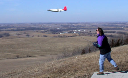
That said, with a trimmed reliable plane and confident pilot, it’s a fine hill close to town. I have even gone up and flown for a few hours after work during long summer days. Great view of pass and a great view of Mt Rainier.
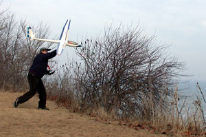
It can be a challenging place to fly, because while the lift can be very large, out landings are savage as described and the landing zone is in a large rotor if the lift is pumping. For these reasons this is a foamy or hand launch hill.
This site is also frequented by hang glider folks, as evidenced by the launch ramp visible in the photos. During the summer sharing the site with hang gliders is common, but usually the lift is large enough for them to run N along the rest of Rampart Ridge and they rarely remain in the immediate area RC pilots use.
Vertical Relief: 1600 feet
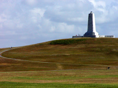
 |
| Rampart Ridge, flying site at center |
Typical Weather:
NW winds are the most common due to it’s location near Snoqualmie pass which acts as a wind tunnel aimed directly at this slope. E and S wind are also flyable but typically more turbulent. During high pressure systems when wind swings in from the east, this is more of a light lift slope. If high pressure is not present and weather is actually moving across the state, it’s most likely blowing W to NW here. Due to it’s proximity to the pass, rain can also be a problem.
Slope Terrain:
Extremely steep clearcut, old logging slash everywhere on the hill, interspersed with recently replanted 15 foot firs. The launch site is open and direct, but small trees here and there need attention if flying close to the deck. Pleasing knob with heather to sit on for flying the S and SE faces.
Flying:.
Lift always good in W to NW wind, often booming big as good as anything elsewhere. Can be smooth or extremely turbulent. Moderate lift is typical. Relatively limited ridge running but large lift band. There is a slightly higher site a few hundred feet north about a hundred feet higher with a S facing aspect. Good sight lines directly W and to the right (NW). If standing near the hang glider launch while flying, care is needed to avoid flying too low to the left, a plane can drop out of sight hidden by the small knob and the couple trees located there.
Landing zone:
Open approach area, with no tall obstructions. The landing zone is the gravel road. Rotor is large and go rounds when aiming for road are not easy because of the need to approach from the backside, where the road is 20 feet lower than the slope lip and if it’s not looking good it can be difficult to make it back out over the slope.
It is possible to ditch in patches of fireweed near the lip, but rotor makes this tricky while at the same time these patches are located for the cleanest go rounds due to their proximity to the lip.
Walk of Shame:
Probably the worst of all sites I’ve flown. Extremely steep logging slash chokes entire hill, and is threaded with sticker bushes. If the lift is good and your plane is flying well, you’ll probably be fine, but the penalty for mistakes is one you will not wish to repeat once you experience it for yourself. Tall brush is everywhere if you get more than a few hundred feet down, I’d recommend a beeper if you are not adept at locating downed planes.
Blowback landings when flying a W wind will typically wind up near the road, there are fewer stickers and it is not as steep, but many small trees impede visibility.
Camping:
Great campsite right behind upper slope site, just continue on road past primary site and take obvious left.
Road Conditions:
Lower portion of approach is paved leading to good gravel road, final couple miles extremely rocky, high clearance is necessary but 4 wheel drive is not.
Getting There:
Take I-90 E from Seattle to Snoqualmie pass, take Hyak/Gold Creek exit 54 about 2 miles E of the actual summit. Turn left and head N under freeway, then take right on Gold creek road, you will now parallel I-90 on it’s N side.
Continue 2 miles until road turns dirt, climb a few thousand feet in a couple miles and look for the second left at 3.5 miles (1.5 miles from beginning of dirt), off the second right hand switchback. There is a sign for the Mt Margaret trailhead at this corner, you do not wish to follow the sign, for us it merely indicates the correct corner for a leaving this stretch of road.
Continue on the side road for a couple miles watching for a left at 5.0 miles (3.0 miles of dirt), which will take you down across Rocky Run Creek. As you proceed you will see the road you want across the valley climbing a clear cut hill, you may even see cars already near the top.
Turn left as described, cross Rocky run creek and start up final approach. It will get very rocky for about a mile, then at a sharp left hand switchback it will get OK again and it’s only ¼ mile to the obvious flying site. It is located on a knob where the road makes a hard right turn, and is marked by the hang glider launch ramp. Total distance is 7 miles from turning onto Gold Creek road, 5 miles from beginning of dirt.
Contact Chris at mtngoat9@aol.com